
Water Scarcity: Elephant Butte Water Reservoir | Sierra County
Kathleen Kambic charts the complicated regime controlling and managing water in the Lower Rio Grande valley.
Sierra and Doña Ana counties receive between 10 and 14 inches of rain per year, necessitating the extensive irrigation system found along the Rio Grande. Irrigation water comes from the river and flows through the ditches to multiple fields to flood the crops.
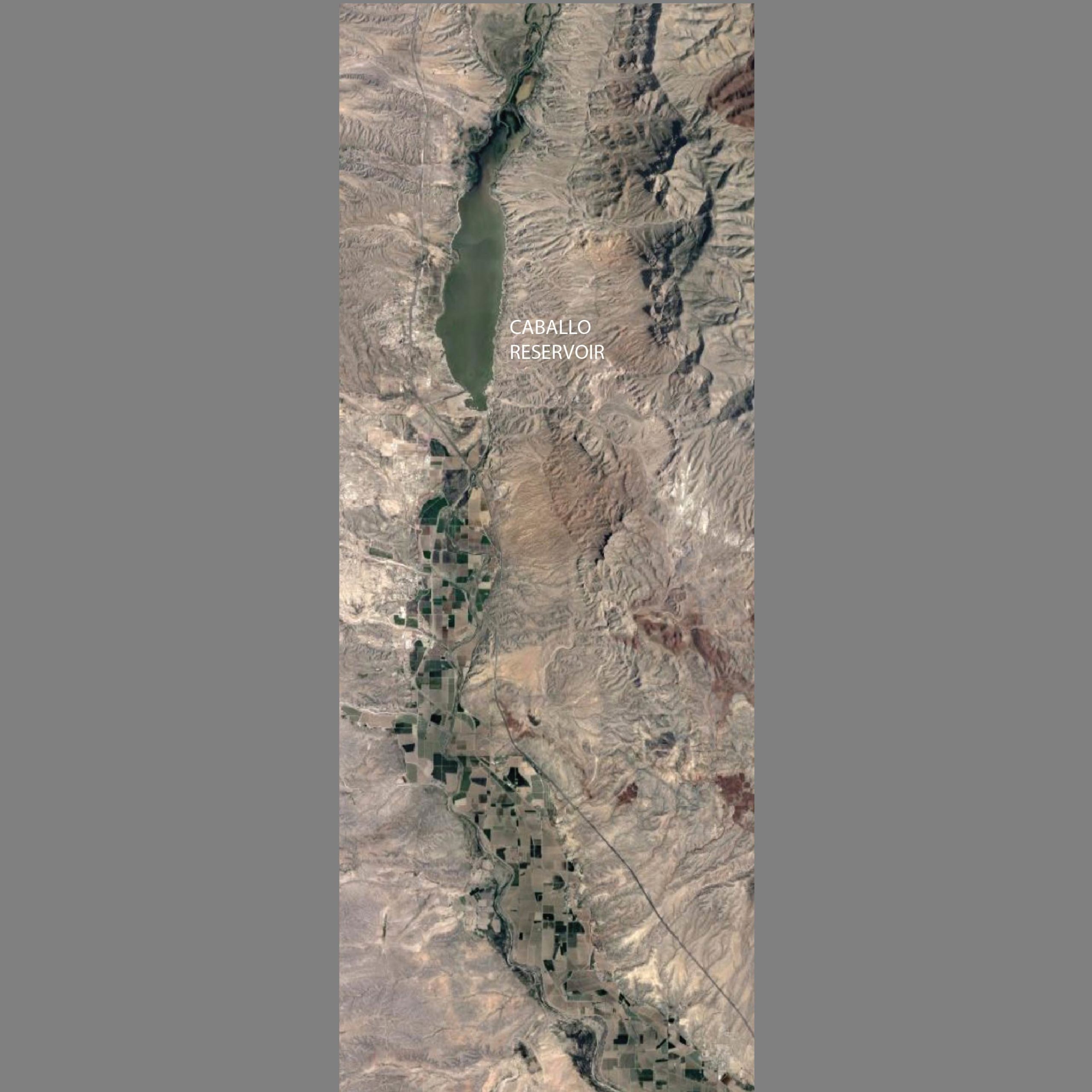
Caballo Reservoir, just a few miles south of Elephant Butte, can hold up to 350,000 acre-feet (AF) of water but usually contains about 50,000 AF in the off season (October through January).
Supplemental storage for the Rio Grande Project provided by Caballo Reservoir helps control floods and limit off-season flows to meet deliveries to Mexico mandated by the 1905 treaty.
The braided nature of the laterals and drains is apparent in aerial photographs. Farmers have always adapted their practices to the topography of the Rio Grande rather than importing gridded geometries found elsewhere in the US. The drains often dead-end in fields after all the water is consumed.
The pattern of trees and vegetables makes a patchwork of the land. In the figure above, the pink lines delineate the delivery laterals from the main ditch. These laterals are constructed based on the topography in order to stretch the delivery of water as far as possible. In an acequia system, which these farms were originally built on, the Acequia Madre, or mother ditch, starts as far upstream as possible to bring water along the highest contour into the lowlands. Water is distributed through water rights, but also through the ditch community, where water is shared in times of scarcity. Within Elephant Butte Irrigation District, water is distributed equally across the board. Well pumping determines who gets their full allotments in dry years.
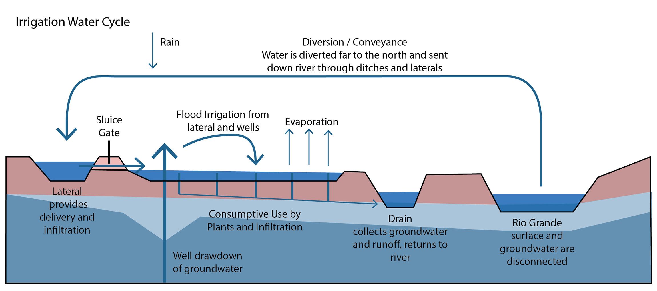
Water is not wasted: The water that flows over the fields infiltrates and helps maintain groundwater levels. It also may return to a drainage ditch (white dashed line) which eventually connects to the river. Agriculture is primarily a consumptive use, so not much, if any, water returns to the ditch. Consumptive use of water is mostly evapotranspiration and plant take-up. The drainage ditch helps collect water in a flood event, in an effort to save the fields from being destroyed.
The section diagram below shows the typical inputs and outputs of water from a field. The movement of water in and through the system is complex and depends on the irrigation districts to get the timing of delivery right. Wells add more water to the fields and surface but pull from the groundwater and ultimately can cause subsidence, soil degradation, and separation of the river from the ground water.
This article is part of “Water Scarcity: Elephant Butte Reservoir,” written solely by Kathleen Kambic, assistant professor at the University of New Mexico. All images are her work alone, unless noted otherwise in the text.
Click here to view this feature’s references.
The views expressed here are those of the authors only and do not reflect the position of The Architectural League of New York.