Water Scarcity: Elephant Butte Water Reservoir | Sierra County
Kathleen Kambic charts the complicated regime controlling and managing water in the Lower Rio Grande valley.
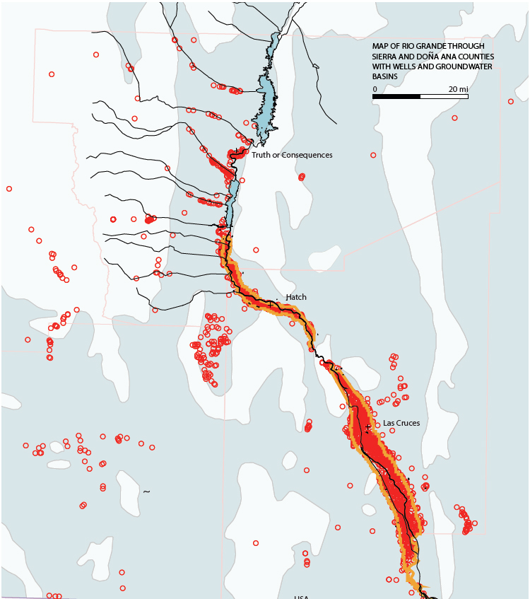
The Rio Grande aquifer (light blue) is part of the Basin and Range geomorphic area of New Mexico. The rock includes layers of gravel, which is where the water of the aquifer resides.
Hundreds of wells have been drilled along the Rio Grande and elsewhere in the aquifer basin. These wells are used for domestic supply, mining, industry, and agriculture. Well depths fluctuate significantly, depending on the rock below and its use.
Due to this formation of rock, oil and gas are also very likely to collect within the aquifer zone. As much as 50% of each of these counties is federal land. The Bureau of Land Management is the largest landholder and leases much of the land to oil and gas companies. Oil and gas are major sources of capital for the State of New Mexico, which is among the ten poorest states in the US. Contamination of the groundwater from fracking, re-injecting produced water, or surface spills is a major concern for municipalities and farmers alike.
Water recharge into the aquifer is extremely important for the Rio Grande and the region as a whole. Domestic water primarily comes from wells. Recharge occurs when water flows through the ground within the basin. Vegetation helps this process by controlling runoff and enabling better infiltration.
Vegetation reduction due to fire, drought, and development causes more water to run off of the land and decreases infiltration. Hotter days and lower snowpack and rainfall amounts have resulted in extreme fire danger, soil dryness (and failure), and severe stress on animal populations.
The Elephant Butte Irrigation District runs from Caballo Reservoir south to El Paso (orange line). During good years, water rights holders within the district can receive about 3 AF of water per acre. In drought times (approximately the last 20 years) water rights holders can receive as little as 11” of water from Elephant Butte. As water volumes drop, farmers switch to groundwater wells to make up for the lost delivery water.
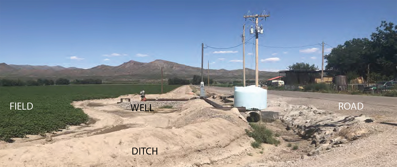
A typical farm near Hatch, NM, with a well connected directly to the irrigation ditches (looking East). It is evident how differently the vegetation grows with and without irrigation.
Continued groundwater pumping has caused a peculiar situation within the Lower Rio Grande Basin: the ground water is disconnected from the river. At times, the river will completely dry up. The ecology of the river is completely destroyed. The diagram in “Water System Mechanics and the Patchwork of Farms” explains how the water can be disconnected. It is estimated that the aquifer can bear up to 300,000 AFY removed and remain viable, but with thousands of acres being farmed, that water disappears quickly.
In the map above, all types of wells are identified as red circles; there are hundreds of classifications. The light blue represents the Rio Grande aquifer system, of which this area lies in the Mesilla Bolson.
This article is part of “Water Scarcity: Elephant Butte Reservoir,” written solely by Kathleen Kambic, assistant professor at the University of New Mexico. All images are her work alone, unless noted otherwise in the text.
Click here to view this feature’s references.
The views expressed here are those of the authors only and do not reflect the position of The Architectural League of New York.