Information technology campuses: Infrastructure and the city in South India
Ameet Hiremath writes about his exploration of the information technology (IT) parks of Bangalore and Hyderabad.
July 17, 2002

Infosys Campus. Bengaluru, Karnataka, India. Credit: Binoyjsdk [CC BY-SA 3.0].
The Deborah J. Norden Fund, a program of The Architectural League of New York, was established in 1995 in memory of architect and arts administrator Deborah Norden. Each year, the competition awards up to $5,000 in travel grants to students and recent graduates in the fields of architecture, architectural history, and urban studies.
Ameet Hiremath received a 2002 award.
From December 2002 to February 2003, I explored the information technology (IT) parks of Bangalore and Hyderabad through walks, drives, photos, and, most importantly, conversations. Because I speak the regional language, I focused on the city of Bangalore, Karnataka, but also spent time in Hyderabad, Andra Pradesh, visiting IT parks and meeting people at the state institutions that impact development. The texts and images included here are partial, open-ended constructs for thinking about the IT landscapes emerging around the globe.
On the surface, India’s IT parks resemble any you might find in Texas, Tel Aviv, or Singapore. But uncovering the threads connecting the parks to the geographies of Bangalore and Hyderabad reveals elaborate fields of infrastructure that link India’s IT parks to its cities in compelling ways. Paths and nodes in national broadband networks, regional roads, and city water distribution configure the daily operations of the IT workplace. My study looks at issues of infrastructure through the lens of the planning and development structures that sponsor IT park construction. To what extent can IT park organization be understood as part of an infrastructural urbanism? What material conditions support the park? How do they get water and broadband connectivity, and what policies foster their growth? Identification card protocols, shift schedules aligned with world time-zones, thirsty green landscapes, on-site power back-up, satellite dishes, and buildings with deep, wired plenums are some of the systems that construct these spaces, while dedicated lines of infrastructure feed their operations. What do these networks of infrastructure tell us about the shape of peri-urban development?
To cities like Bangalore, which are shaped primarily by urban policy and capital logics, the architectural imagination can contribute ways of seeing urban processes beyond those of land-use and other policy-based frames. New frameworks might yield alternate directions to the eager visions for modernization in this and other high-tech cities.
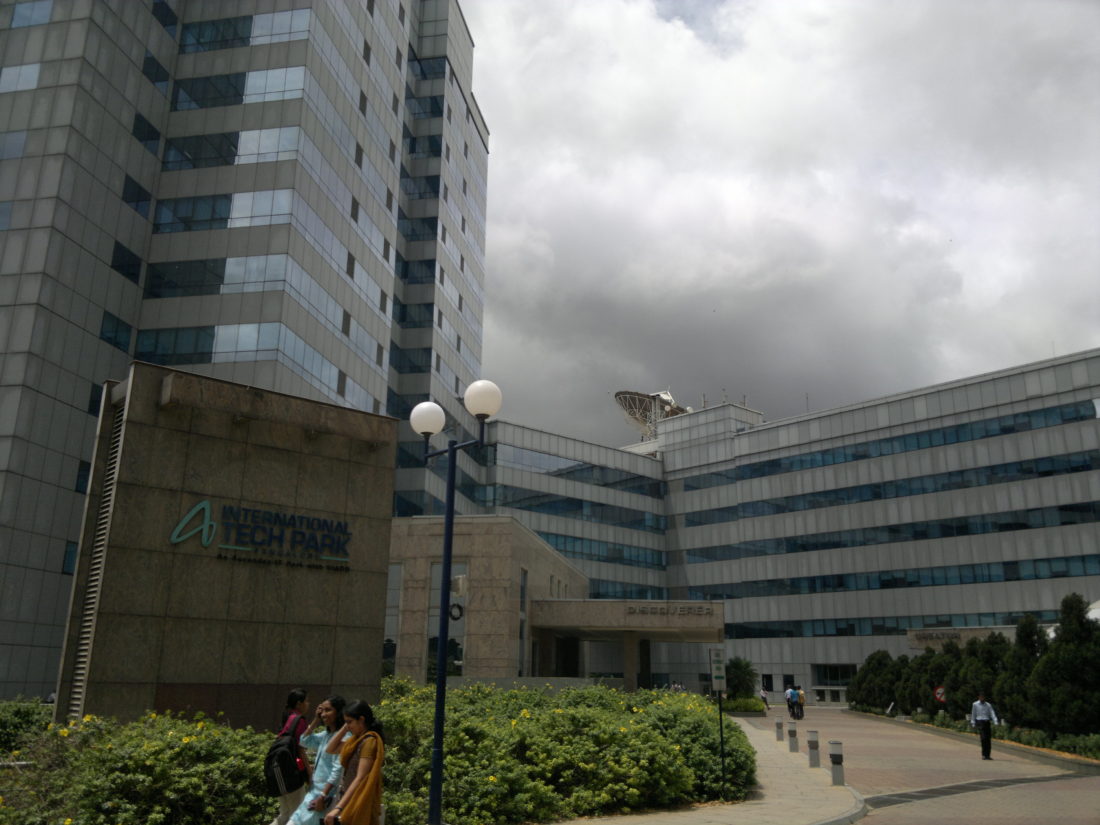
International Tech Park (ITP) Bangalore, India. Credit: Rameshng [CC BY-SA 3.0].
Infrastructure Threads
Bangalore’s network of ebbing and flowing bodies, liquids, and information performs to higher standards than ever before. Much of the municipal work in peri-urban areas focuses on improving existing services whose demand has exceeded capacity. Ring roads quickly fill in missing segments, broadband gets broader, and dedicated buses move between destinations.
Transport, telecommunication, energy, and water systems have always been thought to integrate neighborhoods, bind city center to periphery, and develop political wholes. But water grids and ring roads produce as many boundaries as they eliminate. Scarce resources and existing inefficiencies undermine regulated city services. Underprivileged communities break water mains to access water. In that context, new infrastructure projects provide exclusive paths to connect workers and their workplaces.
Dedicated pathways, including water delivery pipes, telephone exchanges, electricity lines, optic fibers, and private bus fleets, and privileged practices, including land and finance policy, sponsor the spaces of IT production. As such, IT parks are the image of progress in the “Silicon City”. Though the parks are located in distant enclaves at the city’s edge, they are bound, physically and politically, to its core by threads of infrastructure. Each network of grids, lines, points, and switches defines a local material landscape as well as a set of processes that extend beyond the city, often to international destinations.
The Bangalore Infosys campus uses water reclamation systems, but the undulating mounds, green backdrops, and golf holes for visiting CEOs are sustained by the seven hundred thousand liters of water per day delivered by tanker trucks. Underdeveloped infrastructure and under-regulated growth define the periphery of Bangalore. Yet, water and electricity distribution reaches and skips poor areas along its path. The lack of connectivity, a purposeful choice on the part of Infosys, and access, a harsh reality for those who occupy the margins, creates demand for alternate sources of water and energy, such as water delivery tankers, bore wells, local sewage treatment and disposal, and back-up power generators – in effect, a parallel infrastructure. In nations such as India where the modern infrastructural ideal – a term given by Graham and Marvin in Splintering Urbanism to the historical project of pursuing infrastructure modernization as an emblem of progress – is still ongoing, how can we explain the emergence of specialized and privatized networks?
Hierarchical as well as independent systems comprise Bangalore city infrastructure. This contested territory of services might be seen as robust rather than redundant. How might overlapping infrastructures, as a result of regional planning rather than uncoordinated growth, provide greater access than any single system? How might this be a useful alternative to the monopolistic infrastructure projects typical of intense urban growth? Social movements worldwide have pointed to the limits of centralized systems in dense, expanding cities. Proposals for localized energy alternatives are beginning to find a voice in local politics. In this context, strategies of infrastructural urbanism – vectors of physical infrastructure as well as of policy and governance – become instrumental.
Roads to IT Space
Workers at IT parks commute for up to ninety minutes to their offices. Though the parks are located in distant and secure zones, their connections to the city necessarily exist through the daily flow of people and vehicles to the three-shift workplace.
In Bangalore, housing is emerging near the Electronics City and Whitefield area, and in Hyderabad a township-focused development pattern locates housing within the IT complexes. For now, the live-work relationship is attenuated between city and periphery. New construction along the routes traveled by Bangalore IT workers (a new BMW showroom, high-end clothing stores, and enclaves of housing) is visibly upscale. This is opportunistic growth and not planned development strategy. The government- and industry-backed IT Corridor plan to generate development between Electronics City and Whitefield remains a mere vision.
The development of IT space in Bangalore continues along a growth pattern that has located small- and medium-scaled industries on the city’s periphery since the 1970s, fostered by the Karnataka Industrial Area Development Board’s fiscal incentives and land concessions. Today, a demand for larger pieces of land to accommodate the parks’ larger floor plates and extensive landscaping pushes the parks to the city’s edge. The existing transport arteries, such as Whitefield Road leading from central Bangalore City to Information Technology Park and Export Promotion Industrial Park, provide access to new office space, following the logic of large-scale industrial estates from the 1940s and 1950s. Today, city and regional roads are part of government-financed development schemes.
The IT industry cannot supply the number and type of jobs that the industrial city did for residents of peripheral areas and immigrant workers. What does this mean for cities with immense population growth at their edges? Who participates in and who is left out of the service economy in cities like Bangalore? Gayatri Spivak, in a reading of Robert Reich, has commented on a secessionist culture of IT professionals, who increasingly communicate only with their peers around the globe. But even as the amenity-rich IT parks culturally secede from city life, urban policymakers and IT businesses negotiate a material landscape of roads and utilities that underline the parks’ dependency on city mechanisms of growth and governance.
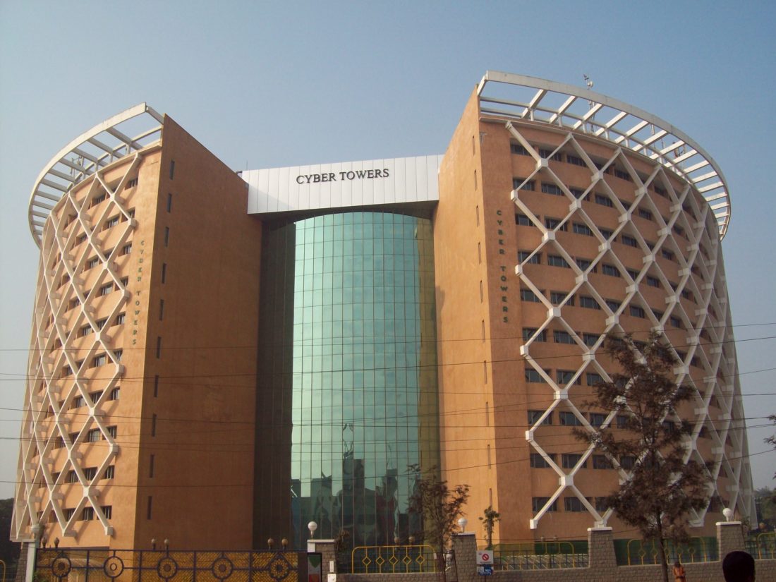
HITEC City Hyderabad, Telangana, India. Credit: Veera.
Got Bandwidth?
Optic fibers, radio waves, and satellite signals channel the flows of information for IT production. The Ministry of Information Technology set up Software Technology Parks of India (STPI) in 1991, to maintain engineering resources for start-up companies and to implement communications infrastructure. STPI provides incentives for locating office space within STPI-serviced complexes and operating through government import and export avenues. Colonel M. Vijay Kumar, as Director of STPI Hyderabad, has the power to declare any private entity a Software Technology Park and therefore grant STPI benefits. In this context, an IT “park” is effectively any office space in the city – not just a gated complex.
In the present drive to increase bandwidth reach, the required infrastructure is both “soft” and “hard”. The connection from an office computer to an STPI earth station up-link, the crucial node for being wired to the world, might involve both radio waves (the electro-magnetic spectrum) and optic fiber lines (underground routes that often trace other right-of-ways such as city roads and pipelines). As such, network access by IT companies depends on overlapping technologies and opportunism. Network expansion is determined by the private business of bandwidth: who can pay? STPI and two other state-operated telecom companies, VSNL and BSNL, are the only providers of earth station links. But “piggy-backing” onto existing private telecom systems in order to reach distant locations is common. The map of bandwidth connectivity is both hierarchical and privileged, but its redundant systems, indeed its inefficiency, allow multiple, small companies to “dial-up” and participate.
Biographies
Ameet Hiremath
traveled to India in 2002. Before and after his trip to India, Ameet Hiremath co-edited Perspecta 34: Temporary Architecture, published in 2003. He has taught architecture as a visiting instructor at Pratt Institute and at the University of Missouri. Currently, he works for Deborah Berke & Partners Architects in New York.
Explore
Rethinking Dharavi: An analysis of redevelopment programs for slums in Mumbai, India
Abigail Ransmeier writes about the successes and shortcomings of slum redevelopment programs in Mumbai.
Bijoy Jain lecture
Bijoy Jain of Studio Mumbai presents recent projects in India.
Rahul Mehrotra: Working in Mumbai
Rahul Mehotra discusses his research and design practice.