A Creek Runs through It
Dept. argues for a hyperlocal, community-oriented approach to flood management in North Miami.
June 21, 2022
Good Nature Stormwater Park. Image credit: Howard Tonkin
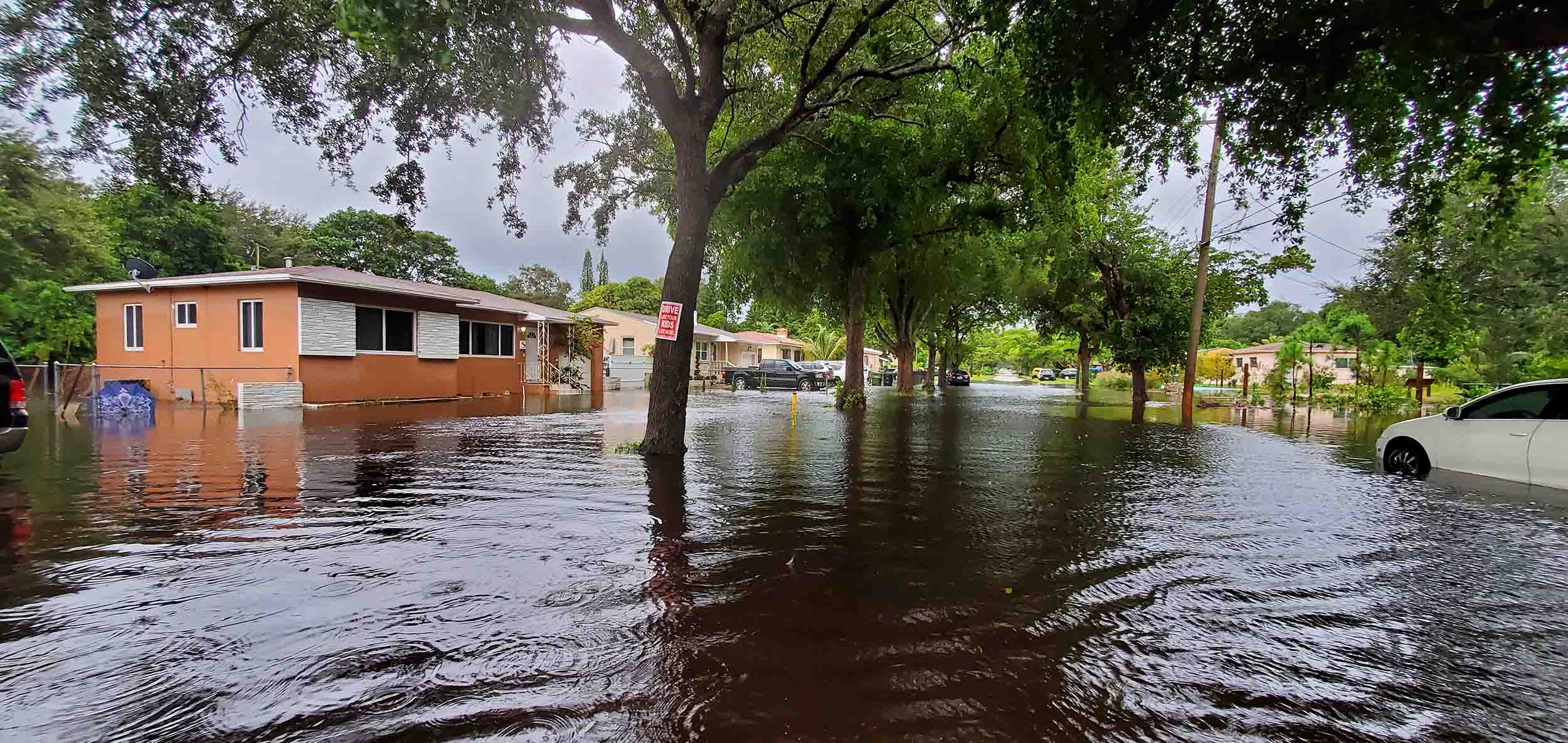
Like many communities throughout the United States, North Miami has an increasingly fraught relationship with water due to climate change. Faced with rising sea levels and worsening seasonal storms, the small South Florida city frequently experiences severe flooding, even on sunny days.
For the landscape architecture and urban design studio Dept., North Miami’s chronic water management issues aren’t just a fact of life: They’re a design problem. Principals Isaac Stein and Maggie Tsang view flooding as a product, in part, of poorly planned urbanization and a disjuncture between people and the ecological systems surrounding them.
In 2019, the studio responded with a pair of innovative flood management projects in North Miami: Good Neighbor Stormwater Park, a stormwater retention basin that doubles as a public park, and Repetitive Loss Vision Plan, a scaled-up proposal for a series of stormwater parks across the city.
The League’s Rafi Lehmann sat down with Stein and Tsang to learn more about these projects: their context, the design strategy, and the community’s role in the development process.
*
Could you introduce us to the Good Neighbor Stormwater Park and the Repetitive Loss Vision Plan? How did these projects come about?
Maggie Tsang: These projects were actually part of Van Alen Institute’s competition called Keeping Current. The competition brief asked designers to re-envision the role of North Miami’s repetitive-loss properties, which are properties that have suffered from more than two major storms or flood insurance payouts.
Isaac Stein: So that’s a home that’s flooded twice or more in a ten-year period. At that point, it can be basically bought out by the government; both FEMA [the Federal Emergency Management Agency] and HUD [Department of Housing and Urban Development] provide matching funds to the local municipality to purchase this property. Once that happens, the property basically cannot be redeveloped in perpetuity.
North Miami, a small suburban municipality in Miami-Dade County, faces significant flood risk. Image credit: Sara McDeavitt
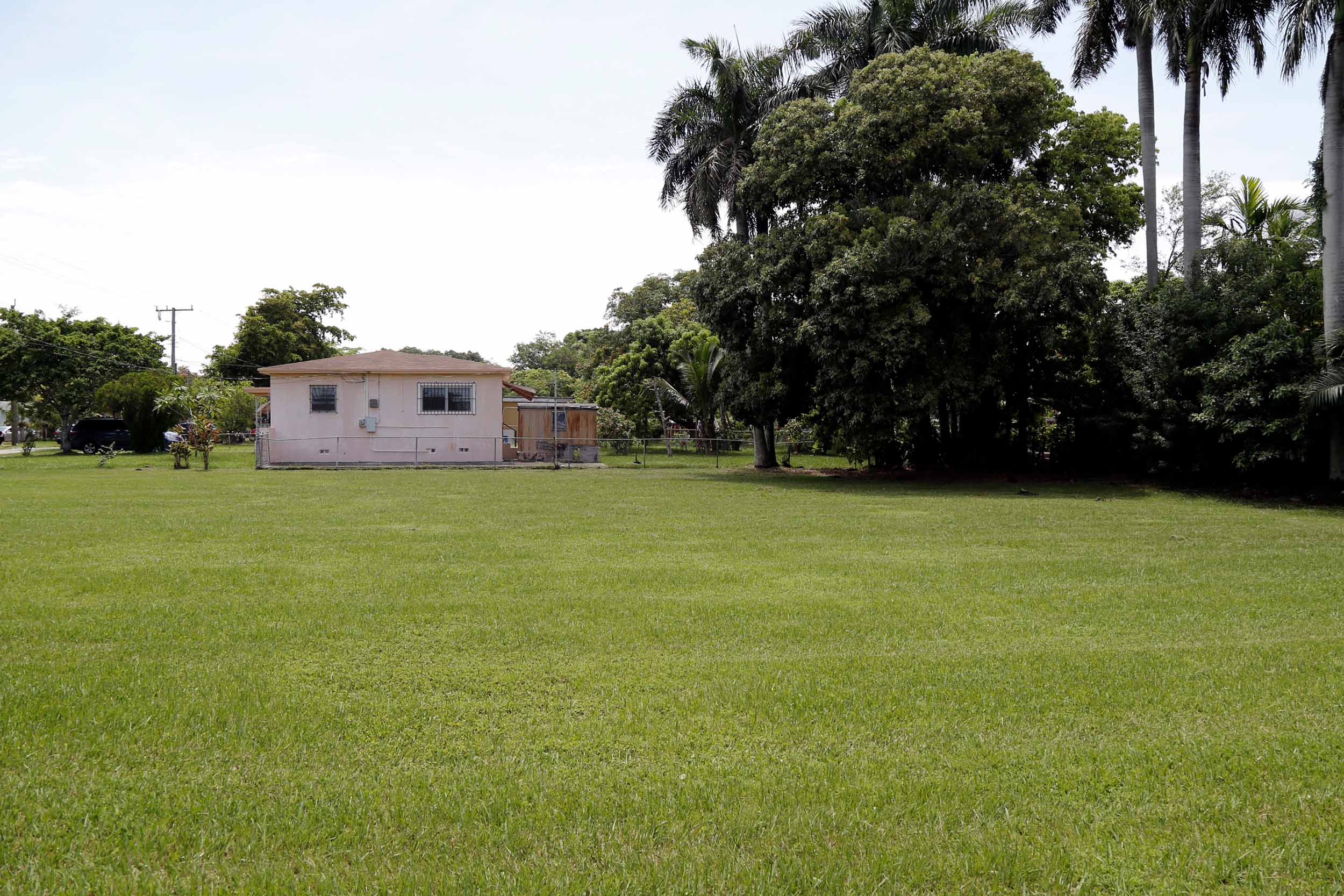
This happens all over the place. There are thousands and thousands of these lots all over the country. And generally, they’re just vacant lots that the municipality has to mow and maintain.
Tsang: So part of the goal of the competition was to think about how to reuse these spaces once they’re purchased. Even though they can’t be developed as housing—shouldn’t be developed as housing—they can still provide some sort of public benefit. So that’s where we came into the picture.
Stein: The first step in the project was to design and build a pilot project on a half-acre lot in a typical suburban Miami neighborhood. And then the second phase was to look more broadly at repetitive-loss properties in the City of North Miami and put together a sort of vision plan.
Tsang: The competition was perfect for us because it was something that we had already been working on. We’ve always been interested in the tension between politics and landscape, or people and the environment. A lot of our previous research or work has examined the way that we, as a society, seek to control nature and the environmental forces that refuse that control.
Can you tell us more about the design you developed in response to the competition brief?
Tsang: So the City of North Miami had purchased a repetitive-loss property where the pilot project is sited in 2000, and it sat vacant for about 20 years before they decided to do anything with it.
Left: The repetitive-loss site sat vacant from 2000 to 2020. Right: Good Neighbor Stormwater Park shortly after completion. Image credits: Dept.
Stein: In fact, the site was platted in the 1950s and they didn’t build a home on it until the late 1970s, and then the home was gone by 2000. The house didn’t even make it through one full mortgage cycle. And that just goes to show you how recent the development is, and also how at risk the location is.
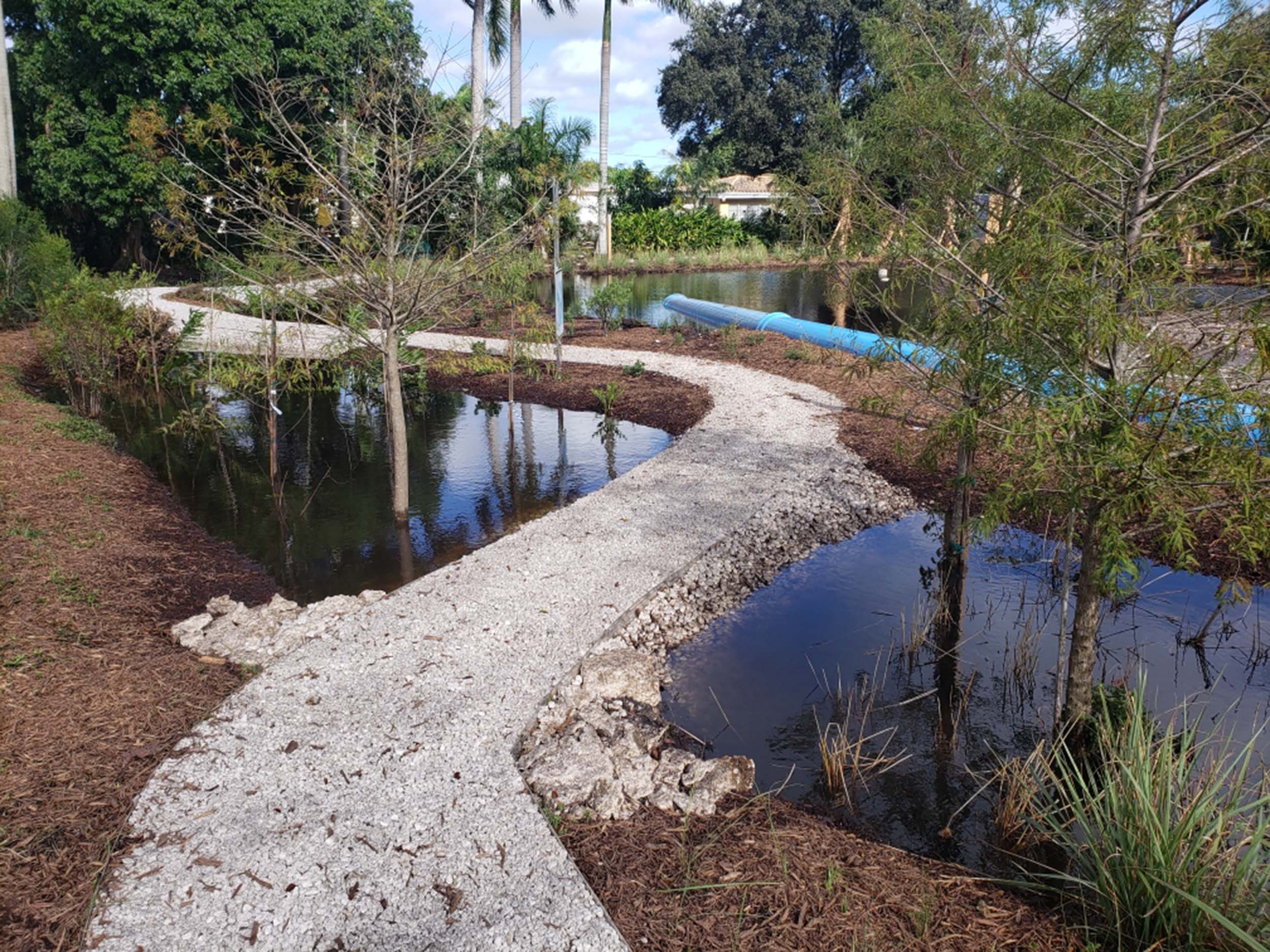
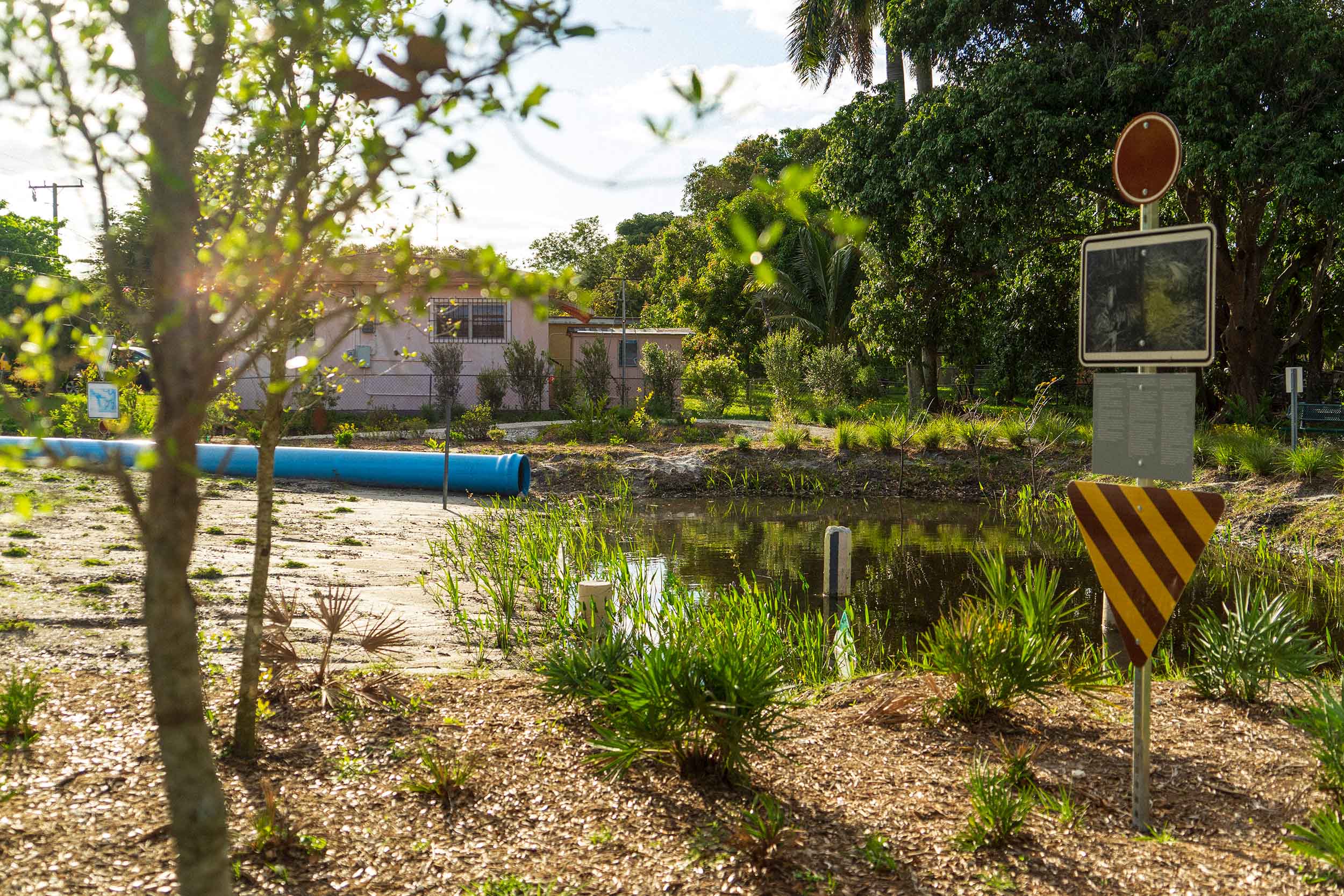
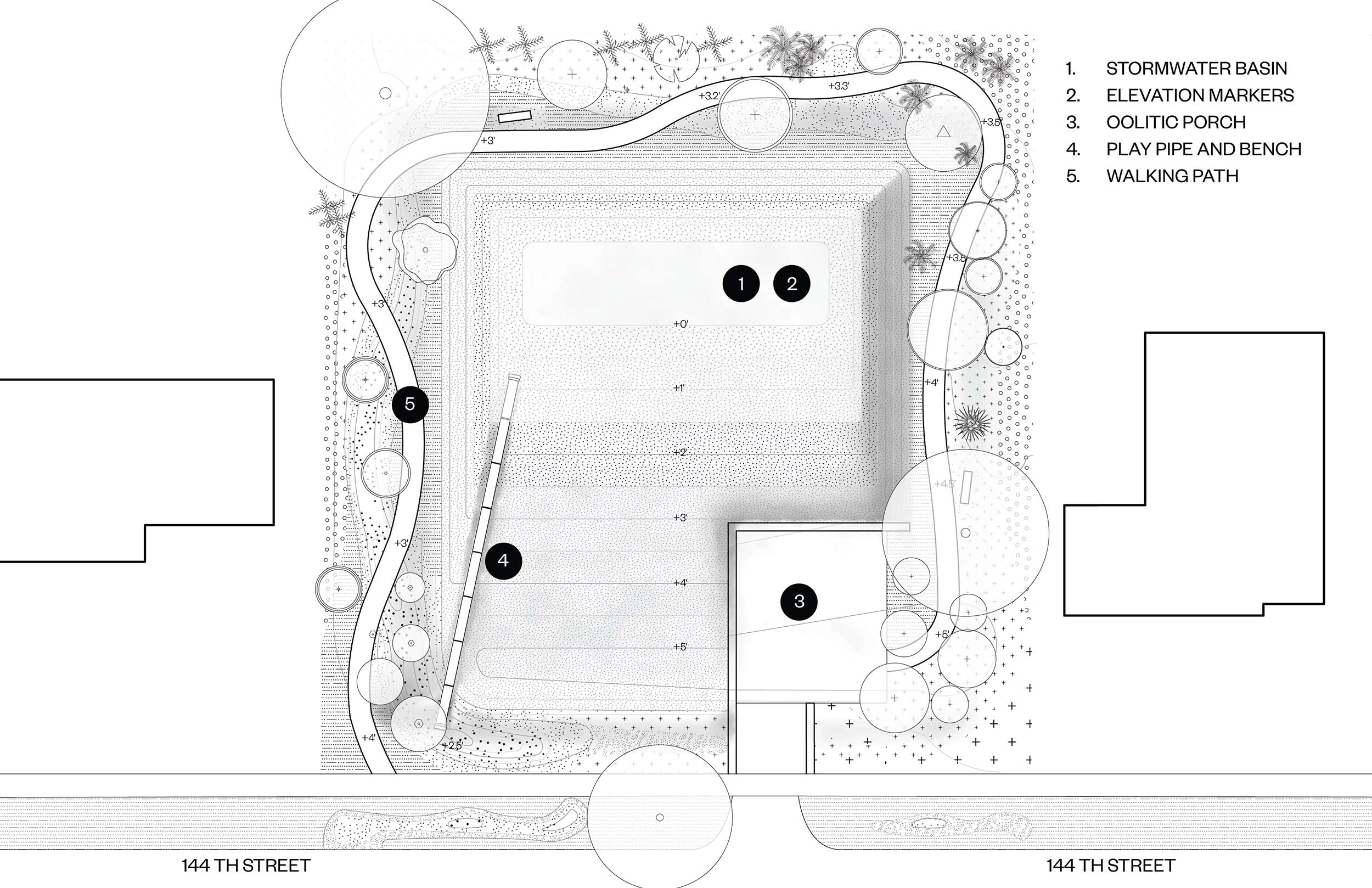
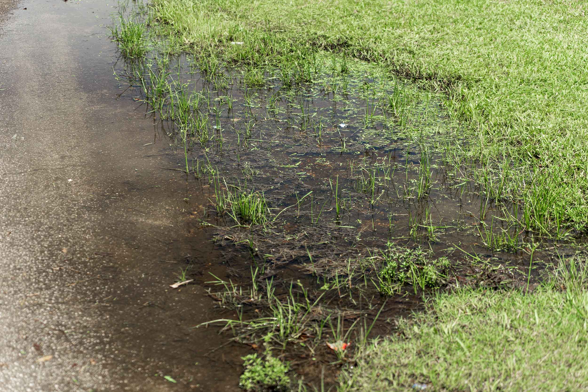
Tsang: So because this repetitive-loss property is at a local low point, our design proposed to dig down several feet to transform the site into a retention basin that can collect and drain water from the neighboring properties.
Stein: Our main approach was to make this site a benefit to the community by reducing nuisance flooding and holding stormwater in rain events.

Concept drawing. Image credit: Dept.
A simple way to understand the concept is: If you have water and pour it in a glass, it holds eight ounces of water. But if you have a glass and it’s filled with eight ounces of soil and then you pour water in, the glass only holds an ounce of water. So basically, air holds more water than soil. In the case of the stormwater park, regrading the site and making a sort of large central basin creates more room for water and mitigates flooding.
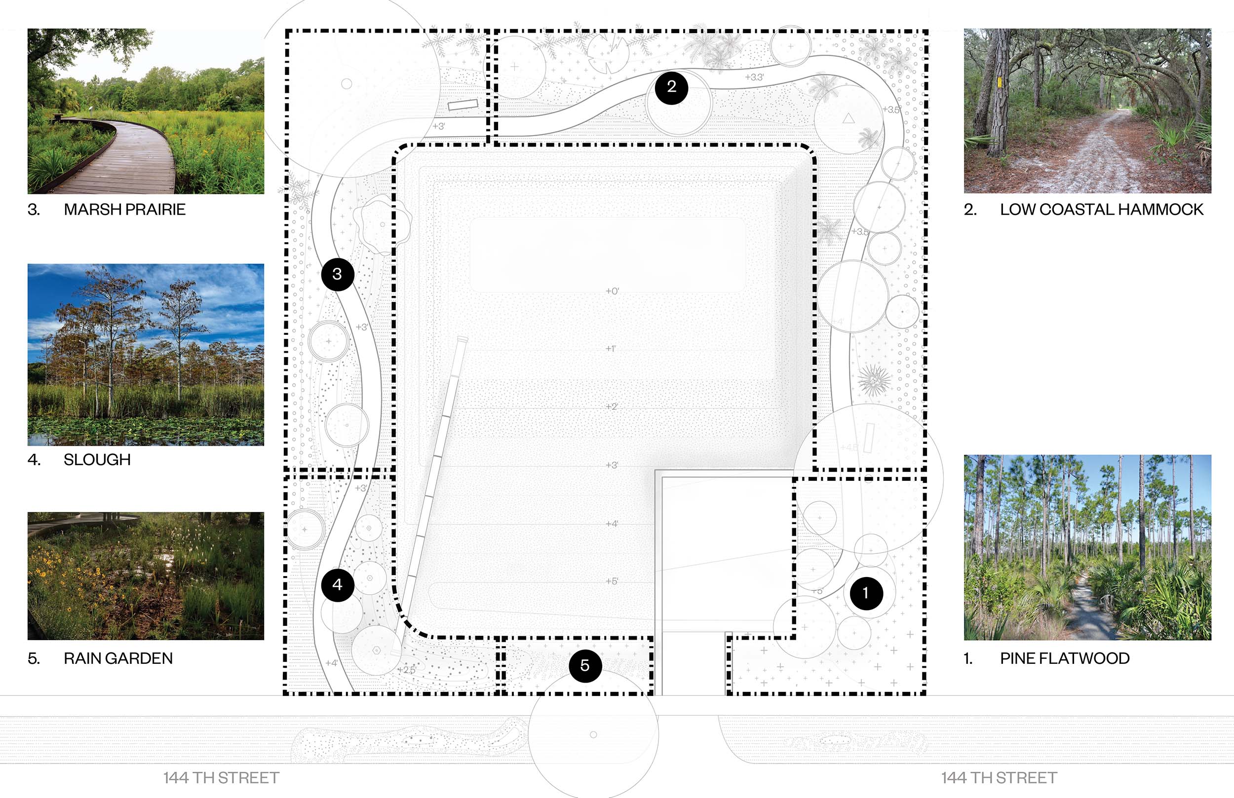
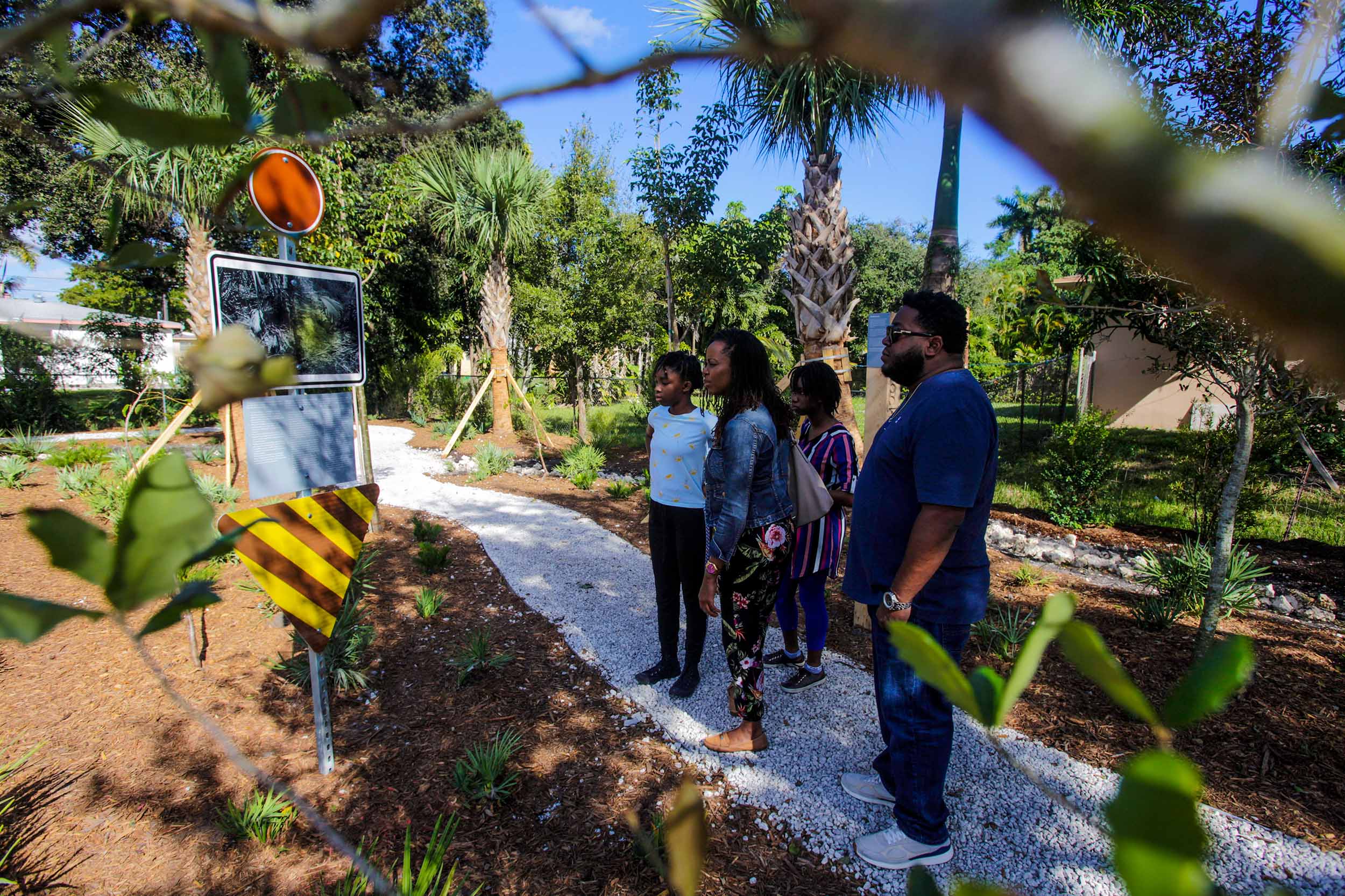
We also dug a bioswale around the perimeter of the site to receive stormwater from the adjacent properties and guide it from a high elevation to a low elevation and into the central basin. And along that path, we designed gardens that represent different plant communities. At the highest elevation are oak trees and palm trees and other species, followed by a marsh prairie at the medium elevation, and when you get to the low elevation you’re in a slough, which is this area’s historic ecology. The slough includes cypress trees and aquatic grasses and red maples and the kinds of plants that love water.
And a new walking path weaves alongside the bioswale around the perimeter of the park so you can walk through the different plant communities from the high elevation down to the lower elevation.
Tsang: Beyond the sheer performance of the site for flooding, it was also critical that the purpose and function of the park was legible to community members. In the park, we have different sign markers within each of the different plant communities describing, like, “This is the hardwood hammock; these are the types of plants that you would find in a hardwood hammock.” “This is the slough; here are the different types of plants that you would find in a slough.” So within the park, we were able to curate the plant material to showcase a range of species found in South Florida that are adapted to different types of flood conditions.
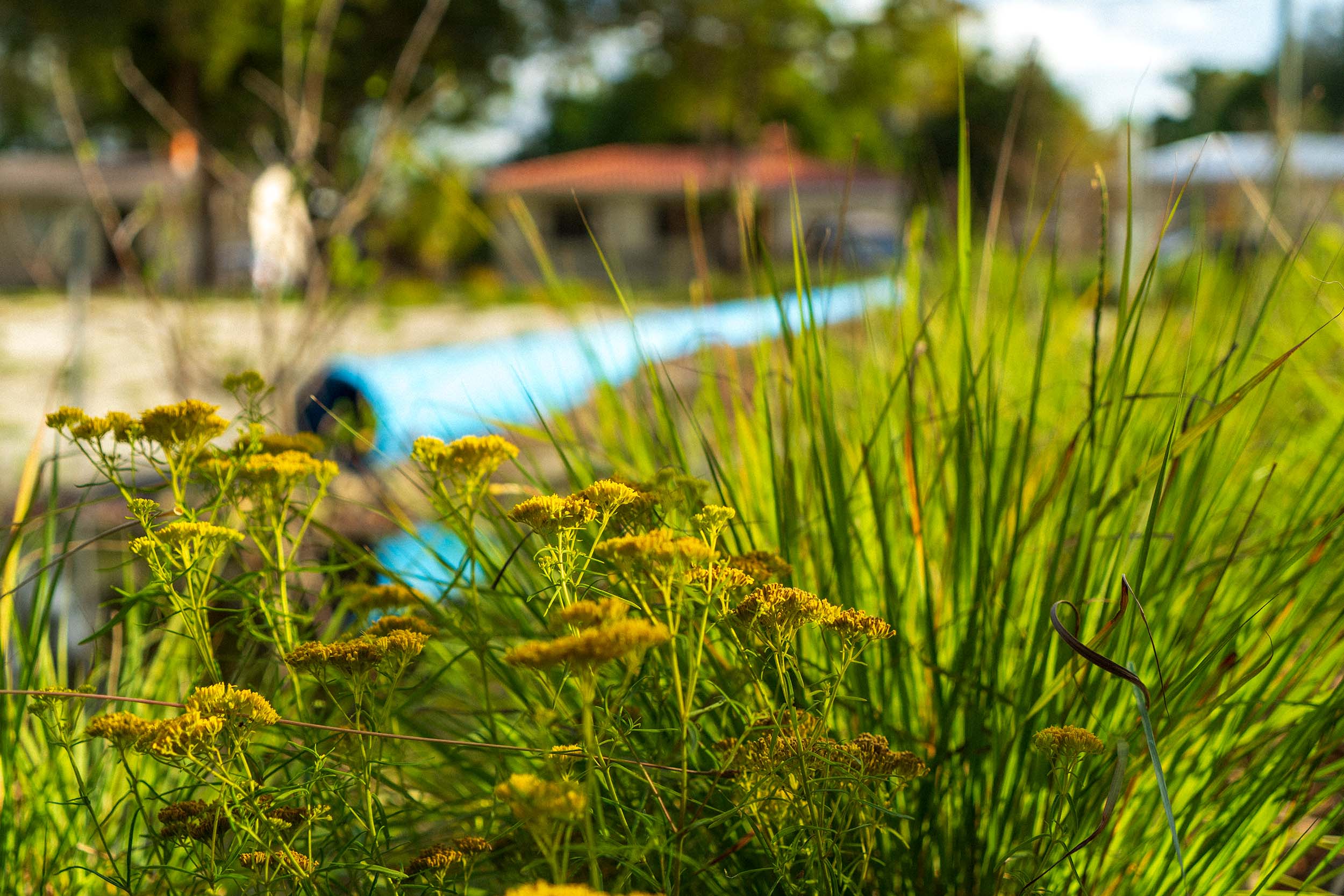
Stein: Typically stormwater features are beneath the ground; you never even see them. But we installed a very large and prominent stormwater pipe above ground. We designed and graded the site in such a way that the pipe was completely exposed and acted as a sort of play structure and bench. We also installed a solar panel that recirculates water from the pond to the top of the stormwater pipe, so when you’re there, you can hear water flowing through the pipe.
View of the oversized stormwater pipe. Image credit: Dept.
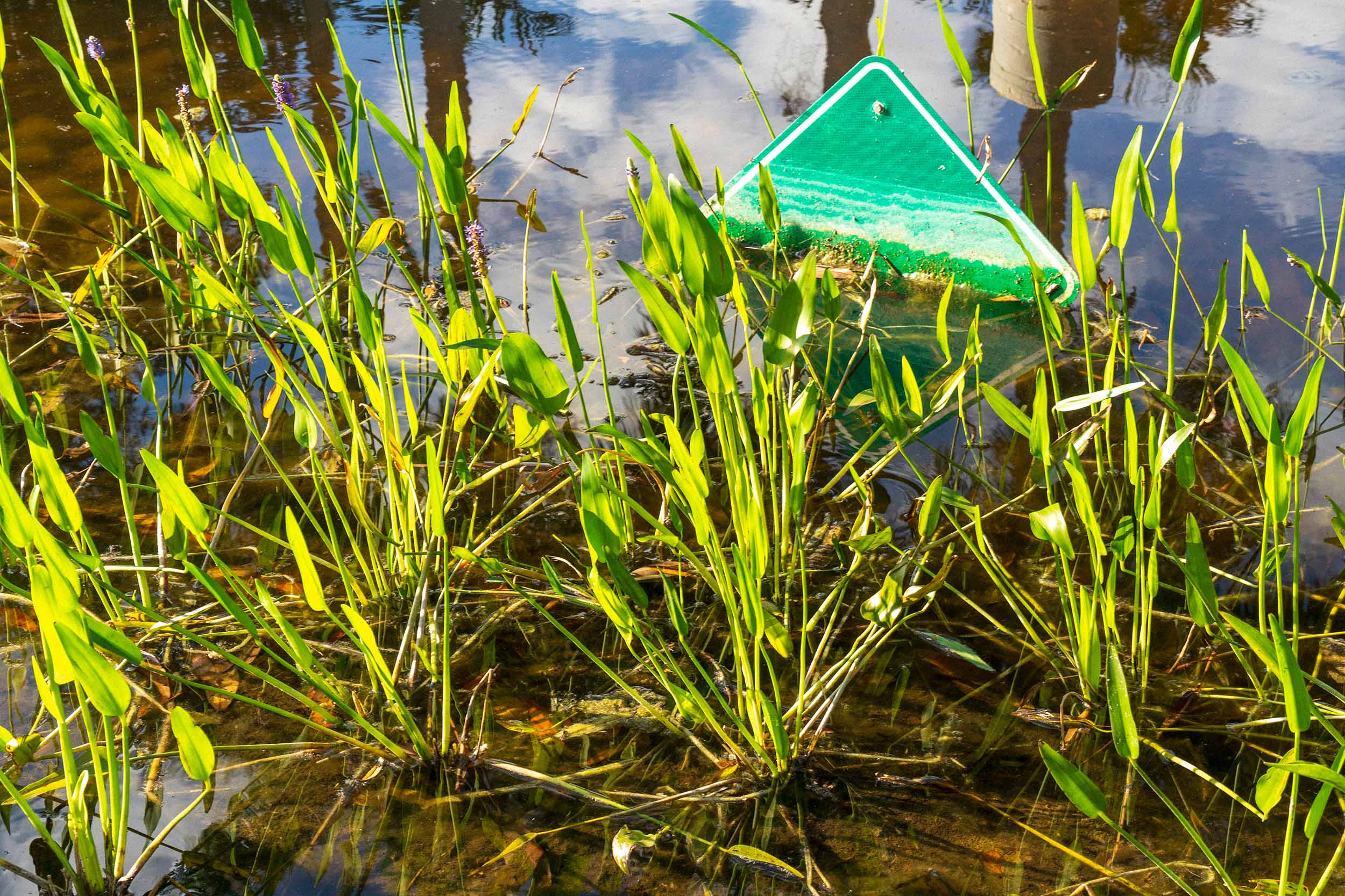
Tsang: We also collaborated with a Miami-based artist named Adler Guerrier to design these elevation markers in the retention pond so you can actually see how high the water is at any given time. There’s also signage that explains the history of the site, why the park has a big pond in the middle, how plants function in flooding, and how the park contributes to the ecology of the site.
Left: A water elevation marker designed by local artist Adler Guerrier. Image credit: Dept. Right: Signs in the park provide visitors with information about the park’s history and ecology. Image credit: Saul Martinez
In this particular case, because the park is in the middle of the block, it was really important for the programming to be simple. The neighbors expressed that they did not want any major activities to take place in the park regularly, like a playground or sports field or anything like that.
The whole project was a low-budget design-build. So we were out there, like, planting everything, getting dirty.
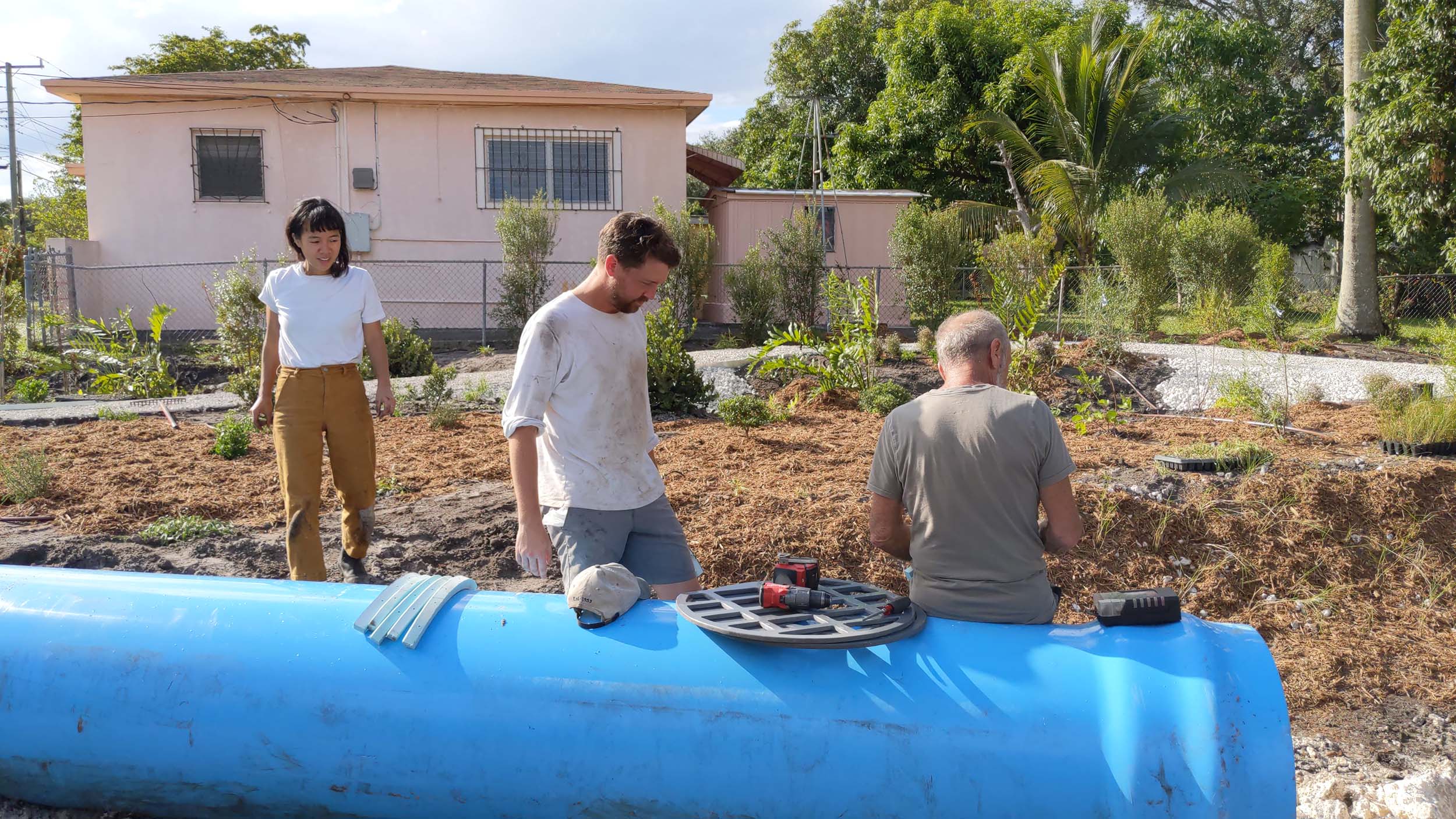
Stein and Tsang working on site during construction. Image credit: Dept.
Can you say more about the rationale behind the buyout policy and how this policy played out in this site and in this neighborhood?
Tsang: Oftentimes we think about flooding at a large scale. The Good Neighbor Stormwater Park dealt with one buyout site, but in other locations there are contiguous buyouts, which is when multiple properties adjacent to one another are bought out together. You can see contiguous buyouts in Staten Island post-Hurricane Sandy, and this is something that The Nature Conservancy and other environmental groups advocate for. It makes a lot of sense because buying out multiple contiguous properties can have a greater impact.
But at the same time, because buyouts have to be voluntary, it is more realistic that we’ll have a checkerboard or scattered-site scenario where lots are bought out in an irregular pattern and they are not contiguous. And so it’s necessary to think about design approaches to these scattered sites. You can’t just neglect the fact that there might be a small parcel here and a small parcel there, and that those can still serve an infrastructural purpose, or can still serve to mitigate flooding in their localized watersheds.
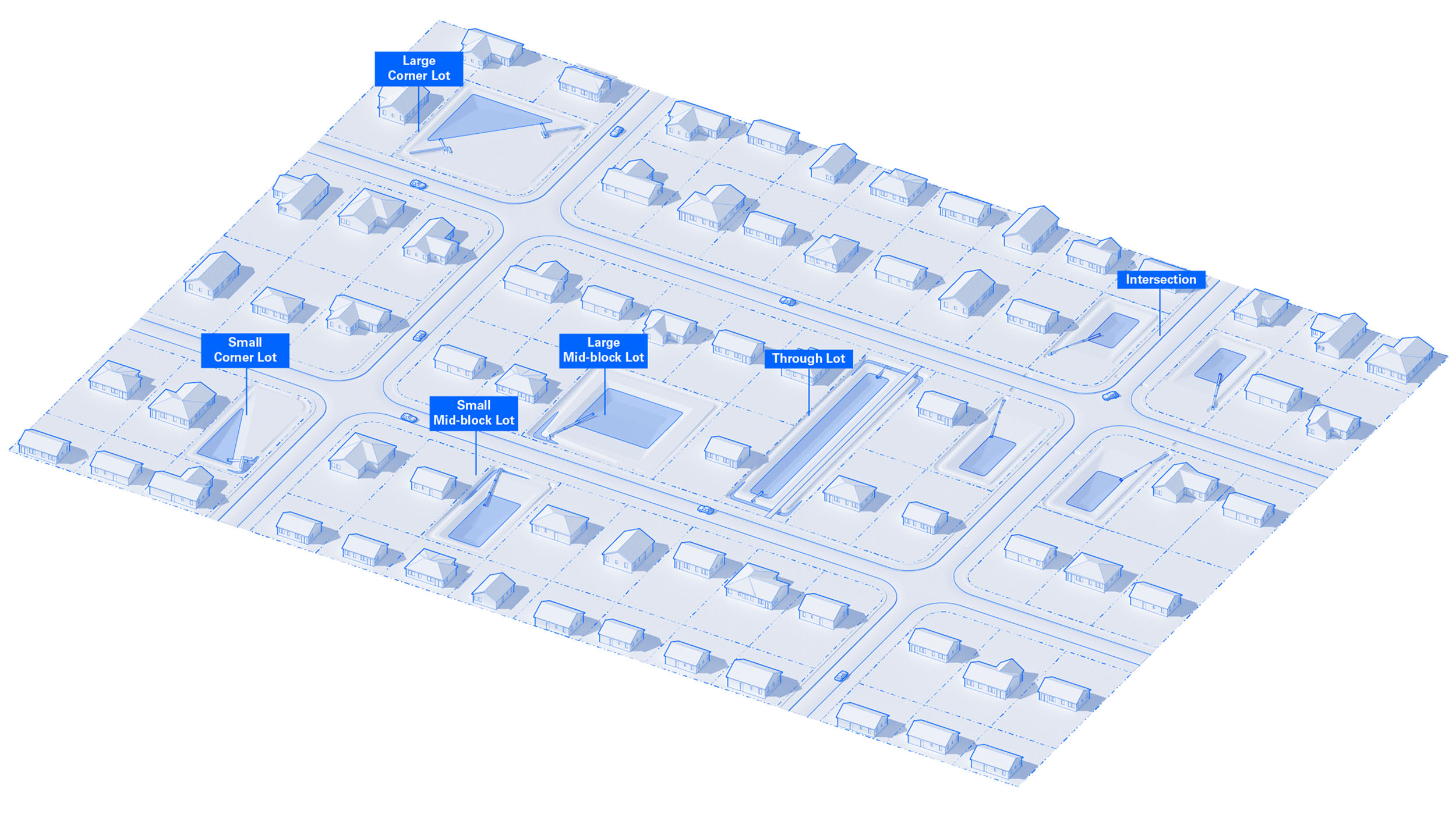
The kit of parts developed for Good Neighbor Stormwater Park can be adapted to a variety of sites and conditions. Image courtesy Dept.
So our approach is not a silver bullet that’s going to fix flooding from sea level rise and climate change in all of South Florida, but we think that we still need more localized approaches to stormwater retention and flood reduction that actually benefit the local neighbors.
Stein: Good Neighbor Stormwater Park might only really affect the surrounding 20 parcels. But if you think of multiple stormwater parks at a citywide scale, they could provide much more of an infrastructural resource, right? If you have 70 repetitive-loss properties and you do this to each property, you’re talking about some real capacity and real improvement. Maybe not for 100-year storms, but for nuisance flooding or more yearly storms, it could make a difference in these communities.
Tsang: Yeah, we know that flooding disproportionately affects low-income communities because of the way federal funding is allotted towards flood protection. Wealthier homeowners can afford to relocate or rebuild where they are, whereas lower-income homeowners or renters have very few options for how to address flood risk. And a lot of the large-scale infrastructural approaches to stormwater management, such as seawalls, very much neglect these communities. So our approach is really trying to think about a smaller scale and a more community-oriented focus.
So the pilot park was a kind of proof of concept for how we might address future repetitive-loss properties given the limitations of large-scale buyouts and the existing context. It was really important to think about the park as a simple set of elements that could be repeated: a retention basin, a stormwater pipe, a bioswale, a way to visualize fluctuating water levels, and some kind of program that is negotiated with the neighbors and the community. Good Neighbor Stormwater Park has a walking path, but you could envision other versions of this park with other programs like basketball courts, playgrounds, or picnic areas.
I would love to hear more about the community engagement you did in North Miami. What did that look like?
Stein: We worked with Urban Impact Lab to hold several community engagement events on the site itself. There was music and food, and we familiarized community members with the project by walking around the site and getting feedback on what kind of program they would like in the park.
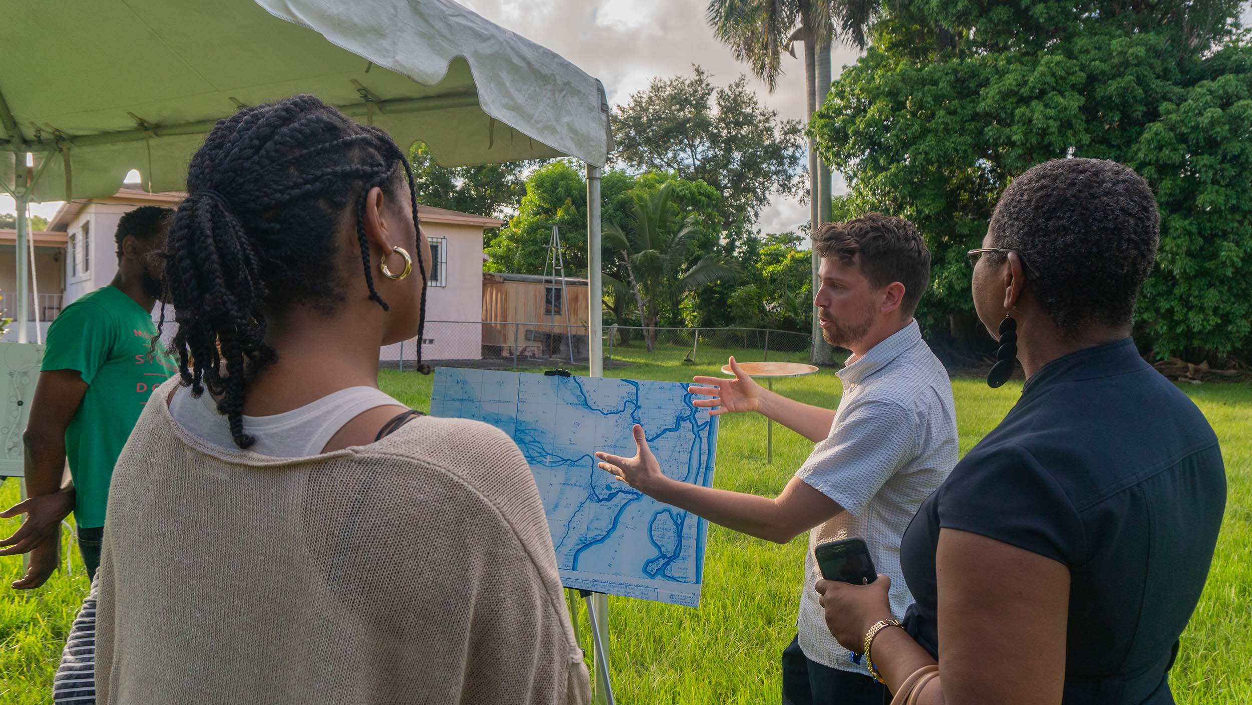
Discussing the site's historic hydrologic flows with community members. Image courtesy Urban Impact Lab
Tsang: We always think about flooding as something that is naturally occurring, but something we tried to communicate through our community engagement is that flood risk is produced through processes of urbanization. You know, the construction of impermeable surfaces, construction within the floodplain: That’s what contributes to flood risk.
Water collecting on impermeable pavement. Image credit: Dept.
Stein: The site is a historic waterway, to some extent. But it’s only when water creeps up to the finished floor that it becomes an issue. And so we try to highlight that tension between the urban environment and the natural ecology and geology of the location.
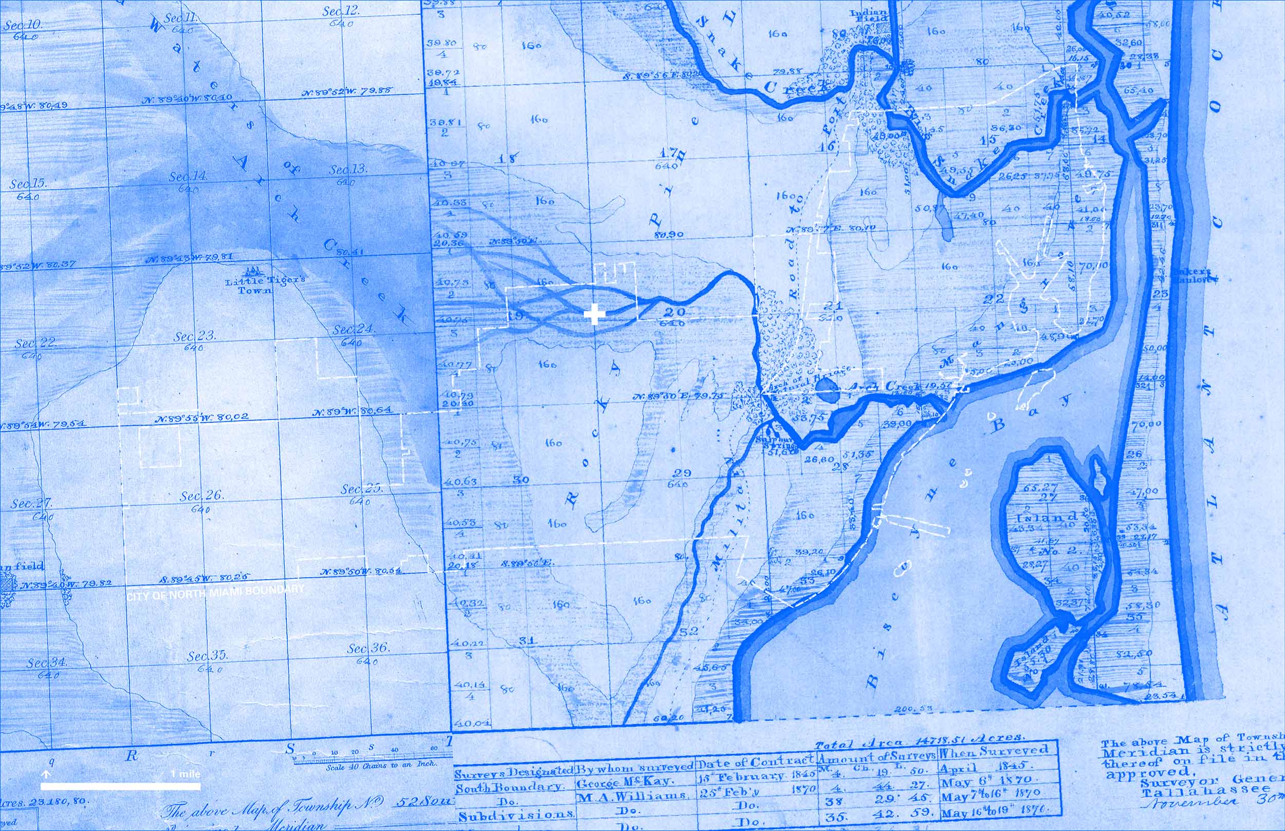
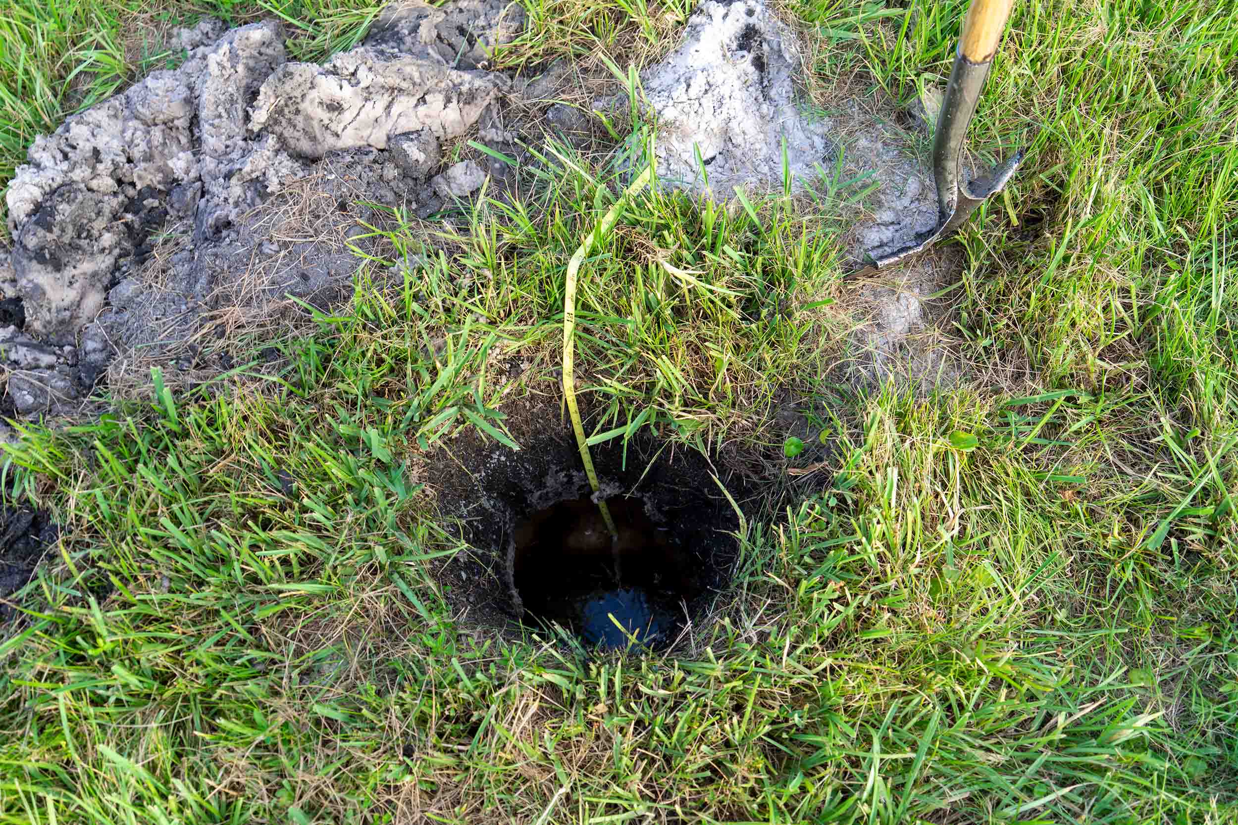
Something that we used quite often when we were speaking to the community members was a survey of the neighborhood from the nineteenth century. With the survey, they could easily see that the park site was once a creek. Then we also ground-truthed this survey by digging a very small hole on site, just 12 inches deep, and then you could see the creek flowing beneath the surface of the ground.
Tsang: Yeah, so neighbors were like, “Oh, I understand why this place floods now. The creek is not gone, it’s just buried.” The engagement process was really about making these historic hydrological flows legible and visible to the community.
Left: A nineteenth-century survey of the neighborhood. The white cross marks the location of Good Neighbor Stormwater Park. Right: Digging a shallow hole revealed the historic creek buried beneath the site. Image credits: Dept.
And obviously that legibility is baked into the the design of the park itself. Because we essentially dug a giant hole in the middle of the park, you can actually see that the water table fluctuates seasonally, fluctuates in response to tides, and fluctuates after storms. And so the people who walk by the park are able to understand this as a dynamic place. We’re not thinking about water infrastructure as out of sight and out of mind, but rather visible and integral to how people perceive the city and the urban environment.
Stein: There’s this disconnect between public perception and the way the environment works. During the opening of the project one community member was very, very distraught that we brought this water into their neighborhood: “Why did you pump all this water into the neighborhood? We already flood. This is not good.”
Tsang: I think that that’s the role of design in all of this. It’s our job to make these systems legible through the space that we design.
Did you face other kinds of community pushback during the project?
Stein: You know, we didn’t face pushback as much as—and this is typical across these sorts of projects—misunderstandings about what it means to have open water next to your house. The immediate neighbors, in particular, were very sensitive to the fact that there would be exposed water. And we had to convey that the water was not a danger but instead was an asset, a public space.
That’s why the park wasn’t just a retention basin. So many stormwater management projects are just holes in the ground that are fenced off and are very much not part of the community. I think the success of our approach was that we thought of the park as something that could tie together both public space and stormwater management.

A stormwater management system hidden behind fencing and shrubs. Image credit: Dept.
And a subtle thing that we noticed after being on site once the project was complete was that people kind of reoriented their backyards towards the park. So that was a nice gesture to observe, a nice way of understanding how the neighborhood was relating to the park.
Stein: I would also say a key thing that always comes up when we work on stormwater retention is mosquitoes. Everyone is concerned about mosquitoes and snakes and bats. You know, “Tall grasses, open water—that’s scary. That seems like it’s going to be a nuisance.”
I think that’s another thing that we, as landscape architects, have to relay: how a healthy ecosystem looks, sounds, and feels. In an unhealthy ecosystem, there are no fish and frogs and bats to eat the mosquitoes. But if you create habitats for these feedback loops to exist, you actually have natural mosquito control.
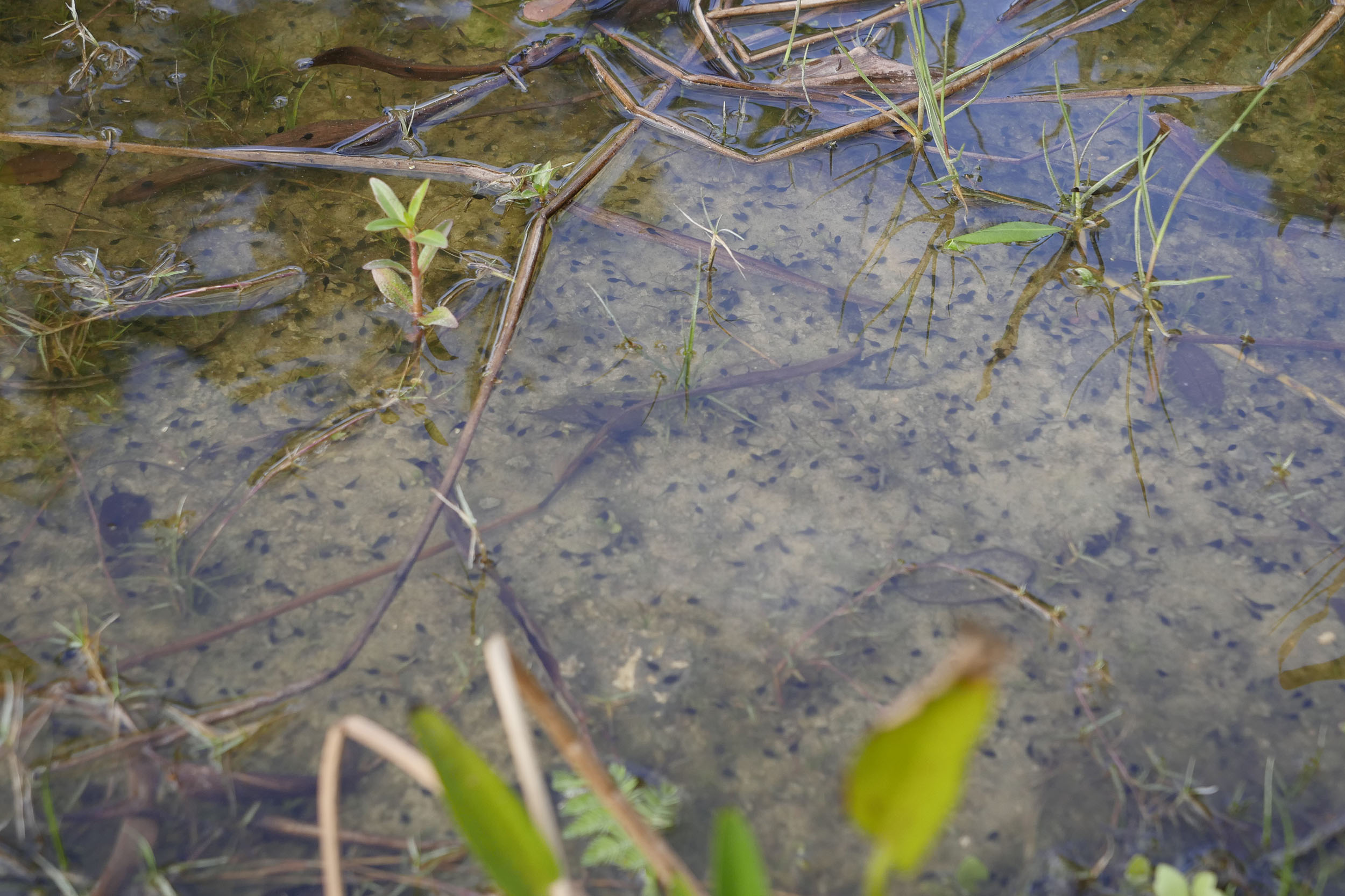
Tiny tadpoles (the black specks in the water) demonstrate how the retention basin is bolstering the site's ecosystem by building habitat. Image credit: Adler Guerrier
Whose responsibility is it to maintain this kind of healthy ecosystem over time? Did the relevant city agencies automatically know how to maintain your design for this purpose, or did you have to work with them to make sure that these systems would remain in place over the years?
Stein: Using natural insect management practices was not something that was standard practice for the local parks department. But the benefit of natural insect management practices is that they’re actually pretty low maintenance long term.
We put in gambusia fish, and these fish are known to eat, like, 10 times their body weight a day in mosquito larvae. They’re a native fish; they’re all over. And so they do a big chunk of management themselves, and they involve no additional maintenance long term. They live there, they thrive there.
Besides the fish, we didn’t do anything. We installed a bat box and the bats have moved in. The frogs have moved in. The birds hang out.
Tsang: The maintenance question is always a big one. Additional maintenance is not something that cities normally want to take on, right? So that’s a critical question in the longer term: How do you bolster stewardship so that a site isn’t neglected?
In some cases, we do think that some of these natural controls, like the mosquito fish, are actually lower maintenance than spraying a lot of really harmful chemicals to get rid of the mosquitoes.
And then in other cases, maintenance is not always a bad thing. I think there’s an argument for celebrating the beauty and life that comes with a new community park or garden that does require a bit more maintenance, but that also gives so much more back.
Stein: Also, because the park becomes a special place, there’s care and stewardship that comes from the community. Local community groups organize cleaning and maintenance events, but also the neighbors look after the space every day.
Interview edited and condensed.
Explore
Nothing Spectacular
With an ambitious project in southern Florida, Germane Barnes is helping a neighborhood envision a better future.
The Beauty of the Ordinary
Adib Cúre and Carie Penabad reflect on Miami's rich vernacular design.
FF – Distance Edition: Studio Roberto Rovira
The multidisciplinary Miami firm hosts a virtual studio visit and project tour.