To Address Mexico City’s Water Crisis, ORU Turns to Neighborhoods
Mexican firm ORU believes district-scale interventions are one answer to the city's longstanding water challenges.
April 18, 2023
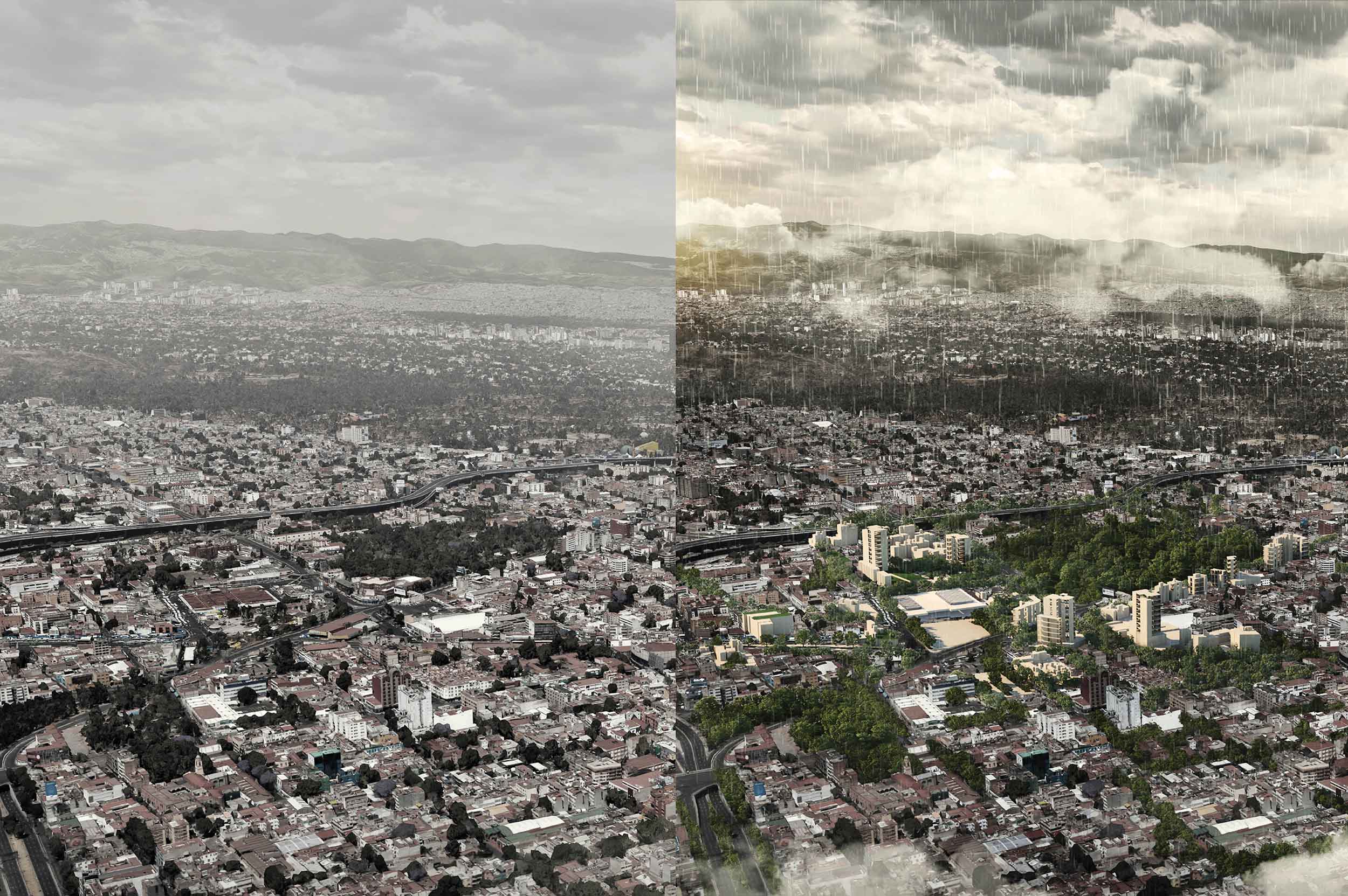
Before and after renderings of ORU's proposed Hydric District plan for the Mexico City neighborhood of Tacubaya. Image credit: Mexico Innovation Fund DRCLAS, ORU, Anita Berrizbeitia, and Mónica Arzoz
ORU – Oficina de Resiliencia Urbana takes a regional approach to architectural practice, seeking opportunities to improve social and environmental conditions through large-scale analysis and planning as well as finer-grained design interventions.
In recent years, ORU partners Adriana Chávez, Victor Rico, and Elena Tudela have applied this approach to the pressing water challenges facing Mexico City, where they founded the firm in 2018. Sinking lower into the ground every year as water is drawn from its aquifer, the Mexican capital is threatened by flooding as well as water shortages. A changing climate promises to wreak further havoc.
ORU’s Hydric Districts project explores neighborhood-scale solutions to these issues, pointing to the need for alternatives to costly, extractive infrastructure megaprojects. The League’s Alicia Botero and Sarah Wesseler spoke with the partners about this work.
*
Alicia Botero: Can you describe the water-related challenges facing Mexico City, broadly speaking, and talk about how the city has managed this resource to date?
Victor Rico: Mexico City was founded in a system of lakes and wetlands in the fourteenth century. Since the basin where these lakes and wetlands were located has no outlet to larger bodies of water, excess water doesn’t have anywhere to go except the ground or the air. As a result, both indigenous communities and, eventually, Spanish colonizers had to deal with the wet condition of the territory.
The Spanish perceived water as a huge obstacle to the establishment of their capital city—so much so that in the early seventeenth century the conquistadors decided to drain the entire system of wetlands, developing infrastructure projects—dikes, channels, aqueducts, and pumps—to carry the water to the Gulf of Mexico.
So ever since the colonial era, Mexico City’s relationship with water has been one of extraction, pollution, and disposal. Water is seen less as an invaluable resource and more as waste. And this extractive model has compounded issues such as water scarcity and subsidence—parts of the city are sinking an average of 10 inches every year—making Mexico City more vulnerable to social risks and earthquake impacts.
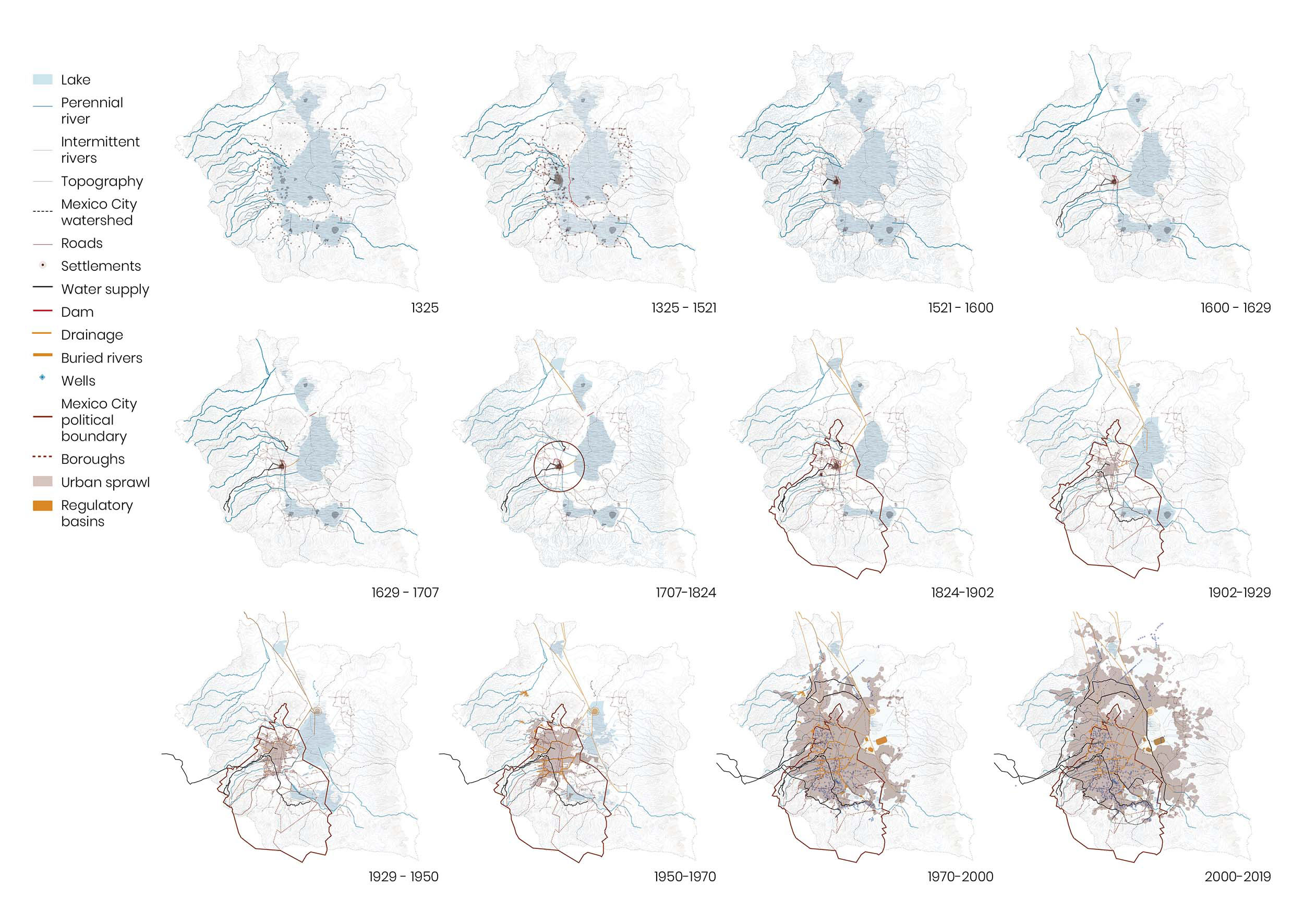
Over the past 700 years, the hydrological landscape of Mexico City (formerly the Aztec capital Tenochtitlan) has transformed beyond recognition, from an organic system of lakes and rivers to a sprawling metropolis with a complex network of dams, basins, pipelines, tunnels, and wells. Image credit: Mexico Innovation Fund DRCLAS, ORU, Anita Berrizbeitia, and Mónica Arzoz. Maps developed using information from Edmundo O’Gorman’s book The History of the Territorial Divisions of Mexico.
This fight to drain the water continues today. So our project Hydric Districts proposes a mid-scale urban model. We think this is innovative because the focus of water management in Mexico City to date has been either at the monumental scale of grey infrastructure, whose main goals are to extract, deliver, and drain the water, or, more recently, at the small scale of green infrastructure projects that aren’t tied into a larger system of planning and operations.
Adriana Chávez: Yeah, the solutions that exist are mega-infrastructures—the Túnel Emisor Oriente and these big infrastructures of water, including massive wastewater treatment plants like the Atotonilco plant, which is mega-infrastructure that took years to plan, build, a lot of resources. These are very difficult projects to realize. Versus very small solutions that can be gardens and filters and other things that are very valuable, but that don’t have an impact on the overall system.
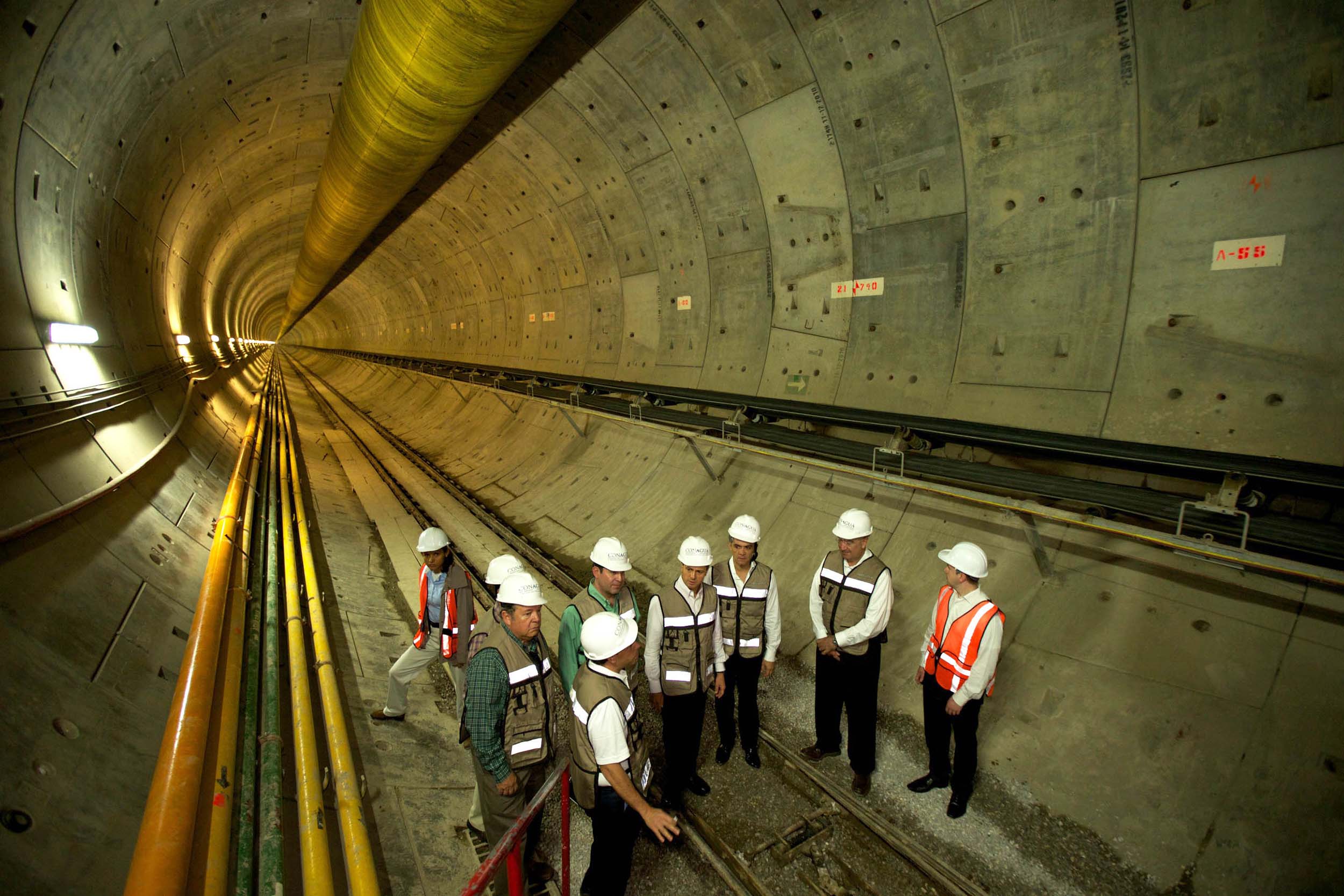
Completed in 2019, the 38-and-a-half-mile Túnel Emisor Oriente (Eastern Emission Tunnel) carries wastewater from Mexico City to a treatment plant in the neighboring Hidalgo state. Seen here during the construction phase, the enormous tunnel can transport up to 150 m³ of sewage per second. Image credit: Flickr account Presidencia de la República Mexicana via CC by 2.0
Rico: So the Hydric District is a medium-scale urban model whose premise is that the water that reaches the Hydric District stays in the Hydric District. And that means that we have to design to make room for that water. It’s an urban model that begins to behave less like a drainage system and more like a sponge. It handles different types of water—mainly rainwater and wastewater—and proposes different strategies for each.
For example, we propose that rainwater that falls on rooftops, which is cleaner than the water that falls on streets, should be stored and used in the buildings that catch that water. But the rainwater that falls on the streets would be channeled to sustainable urban drainage systems, or SUDS, not to the main drain. That way, it stays in that neighborhood.
And what about wastewater? This water is also sent to a system of local treatment plants that can be accommodated in, for example, public spaces, where people can see how water is being treated and used in the irrigation of these same public spaces, gardens, et cetera.
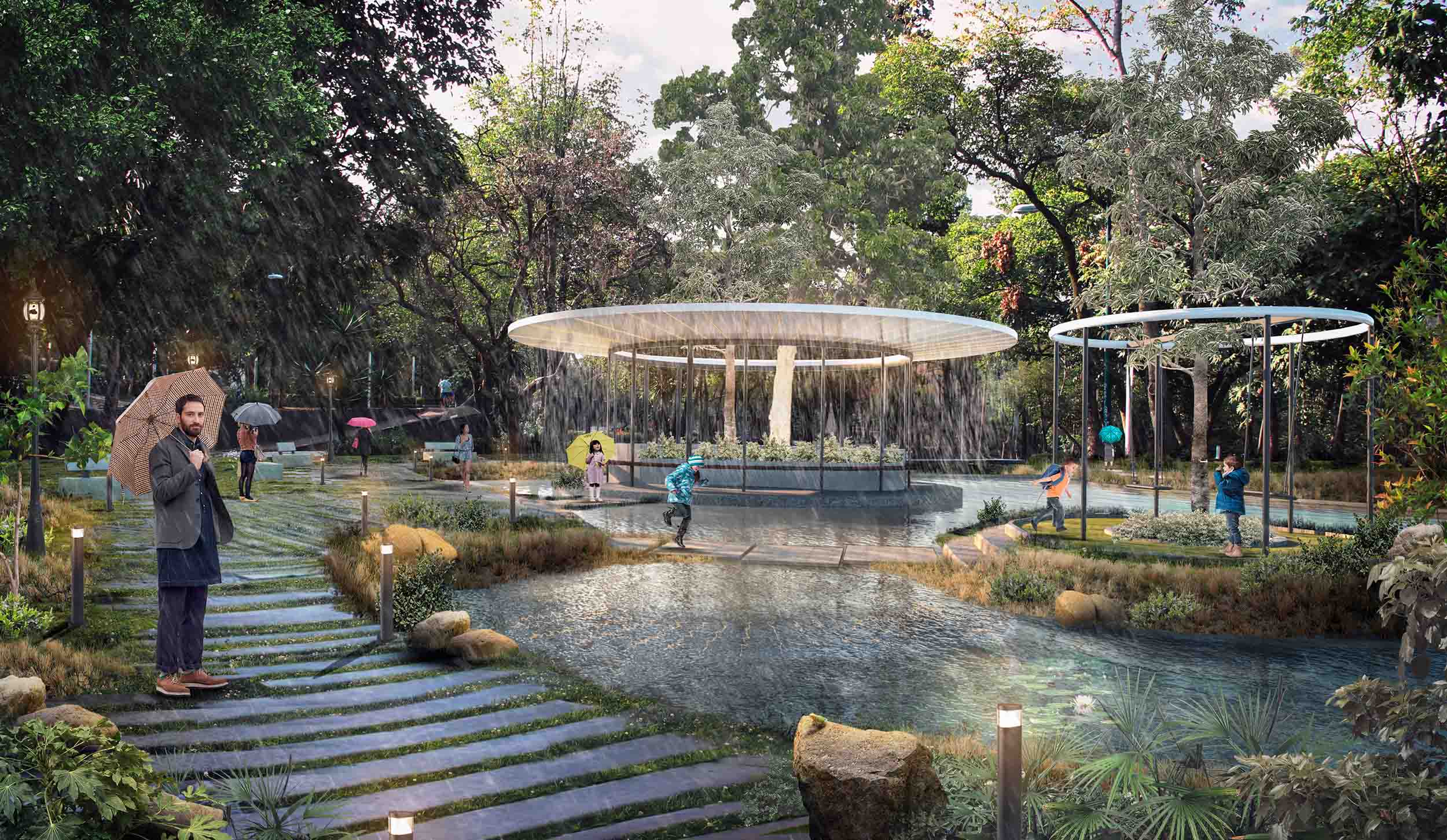
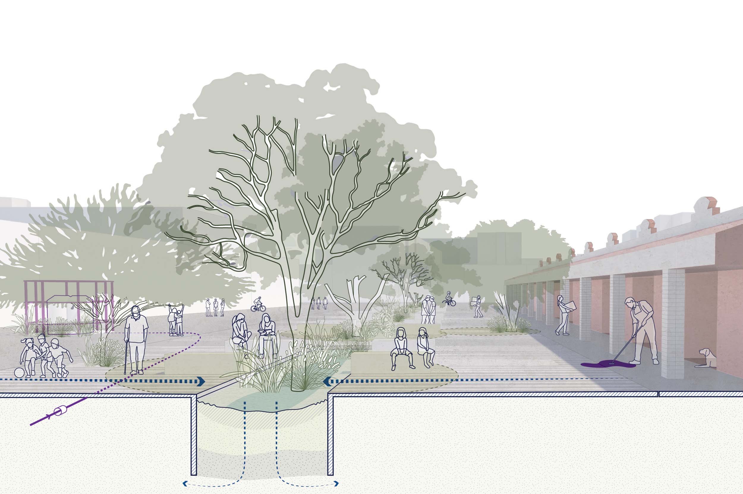
The Hydric Districts project proposes a series of neighborhood gardens where community members can interact with water management infrastructure. In these gardens, rainwater is absorbed and reused, not discarded. Image credit: Mexico Innovation Fund DRCLAS, ORU, Anita Berrizbeitia, and Mónica Arzoz
So the idea is to design for water, with water—and also realize a whole series of social and environmental benefits in Mexico City as a result of keeping water in a neighborhood.
Elena Tudela: For us, it’s very important that design encompasses urbanism, landscape, architecture, and urban design, and that it somehow addresses the main challenges of the future.
And we believe that the discipline of architecture is somewhat disconnected from these great challenges, as if there’s nothing architects can do about them.
So this project—an applied research project—has allowed us to explore one of the great challenges of any city today, which is urban resilience, particularly in terms of water management.
We know that the climate crisis—which is also something that architects tend to have very little to do with, as if there was nothing to be done—is associated with increased hydrological risk, right? It will rain more, and more intensely. We’ll flood more. There will be more droughts, more water stress than there already is in cities. And this makes it even more difficult to meet the demands of growing urban populations. So how can we deal with these adverse hydrometeorological events from a designer’s perspective?
So essentially, this project explores how urban development has been separated from water supply sources and drainage systems, then proposes ways to integrate them.

At left, a diagram of current water cycle conditions in Tacubaya, where 19 percent of rainwater is drained out of the neighborhood and only 5 percent infiltrates the ground. At right, ORU's proposed alternative, where a series of neighborhood-scale design interventions would allow rainwater to be treated, reused, stored, and filtered by the local community. Image credit: Mexico Innovation Fund DRCLAS, ORU, Anita Berrizbeitia, and Mónica Arzoz
This project arises from the needs of a series of developers, managers, and government entities that are questioning how to provide water for the urban development occurring in cities, and particularly how to provide it at the scale of a district or a neighborhood where development is happening simultaneously.
So far there haven’t been many explorations of water-management models at this scale in Mexico City. And those that have been done have mostly taken a strictly technical approach; they haven’t considered questions like, how can we imagine the governance of the territory, of water, of communities? How do we involve citizens? How can we make it so that, through the design of water management systems, citizens also participate and become conscious of what’s happening?
Chávez: Another central issue: Right now, water management in Mexico City is a linear and extractive system. That means the water is extracted from the overexploited underground aquifer beneath the Valley of Mexico or brought from outside the basin, and then it reaches houses. You turn on the tap, the water gets used, and the water gets discarded, and it even gets sent back out of Mexico City.
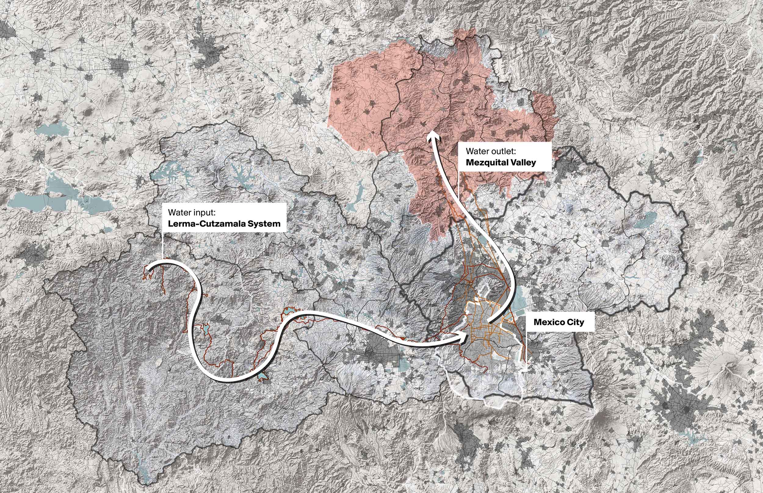
Through a network of pipelines, canals, dams, and tunnels, the Lerma-Cutzamala system imports 22 percent of Mexico City's water from rivers, reservoirs, and lakes up to 124 miles from the city. Once used, this water is exported to wastewater treatment plants in the Mezquital Valley to the north. Image credit: Mexico Innovation Fund DRCLAS, ORU, Anita Berrizbeitia, and Mónica Arzoz. Map developed using information from INEGI, 2015, and CONAGUA, 2016.
So this is a linear system, and the idea of the Hydric District is to propose a circular and decentralized system.
And this also goes back to Elena’s question about how the city can continue developing, continue growing, if there’s not even enough water for the people that live there today.
So this is also a proposal that bets on what the future of Mexico City could be. And we have tested this idea. The first round of investigation was in Tacubaya, a district in the center-west of the city, but we’ve also piloted it in other areas. The second zone that we explored it in was Coapa, which is located to the south of the city. And Victor has had the opportunity to explore models of Hydric Districts in other zones.
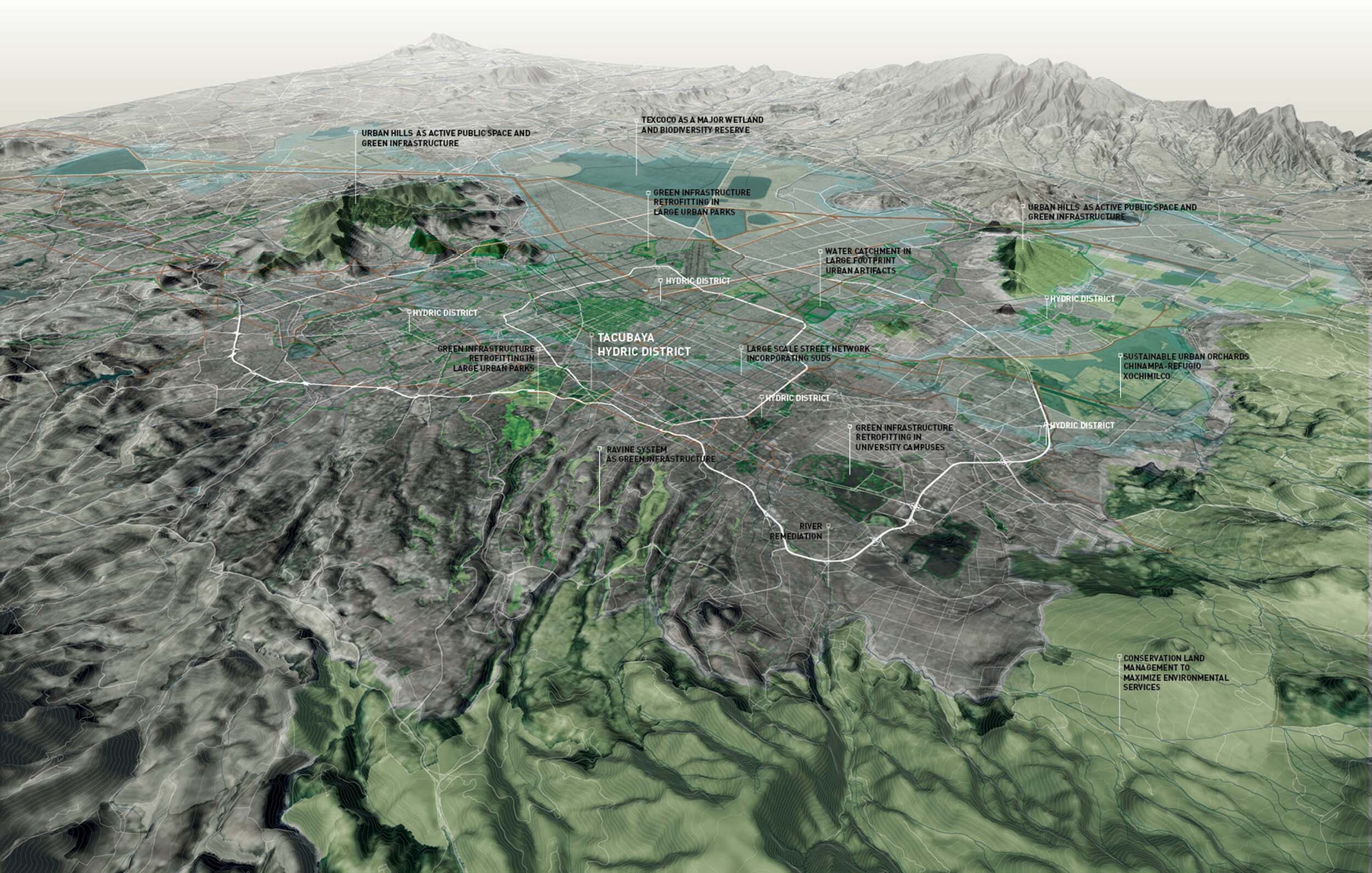
In ORU's Hydric District project, the Tacubaya Hydric District is one node in a larger system of decentralized water management projects across the city. The system would make use of the city's geographic elements, like urban hills and ravines, as well as retrofitted urban parks and university campuses. Image credit: Mexico Innovation Fund DRCLAS, ORU, Anita Berrizbeitia, and Mónica Arzoz
Sarah Wesseler: How did the Hydric Districts project first start?
Chávez: The first time we worked on this concept was in one of our first projects. We got a contract with SAC Tacubaya, which was a group within Mexico City’s Department of Urban Development and Housing [SEDUVI] that was working toward the development of the Tacubaya district. The planned development included urban retrofits such as the creation of new housing and the renovation of streets, public spaces, and transportation infrastructure, among other elements of the neighborhood
They realized that it wasn’t feasible to densify the district unless the water supply was guaranteed and new water management strategies were created. The water infrastructure in this area is very old, so the current drainage system needs to be replaced. And that’s why SEDUVI contracted with WRI, the World Resources Institute in Mexico. And WRI commissioned us to do this proposal.
We should also say that the detailed knowledge of Mexico City that we brought to this project came from work we’d done before. For example, before the three of us formed ORU, we put together Mexico City’s bid to be part of the 100 Resilient Cities program. And later, I joined the Department of the Environment, the City agency responsible for carrying out Mexico City’s Resilience Strategy. Victor was working for the Public Space Authority, the City agency dealing with public space, and Elena was at UNAM, and was also the urban design coordinator of a project called La Quebradora, a water park that won the Holcim Award.
The three of us also put together a very important document called “Towards a Water-Sensitive Mexico City,” which analyzed the city to understand how different parts of the city could capture rainwater, how they could function as a sponge.
Sometimes the term “green infrastructure” is used indiscriminately, and there’s a sense that all green infrastructure strategies work everywhere in the city. But that’s not true: You need to do a specific analysis for each area. So for that report we mapped the city to understand the different zones that exist. For example, the middle zone is well-suited to recharge the aquifer, whereas the lower zones are better placed to reuse water and capture water.
This graphic from "Toward's a Water-Sensitive Mexico City" identifies the distinct hydrological possibilities and limitations of different urban regions. Image credit: Autoridad del Espacio Público de la Ciudad de México, De Urbanisten, CAF
The idea of the Hydric District was born when we were working on the question of the SAC. But it occurred to us that instead of thinking about the development of Tacubaya per se, we should be working on the broader issue of the Hydric District.
The idea gelled over time. We put it to the test with a research grant from the Mexico Innovation Fund from the David Rockefeller Center for Latin American Studies. We already had some maps, some partners from our previous work, but the grant allowed us to do more analysis and, above all, to generate design proposals. In the first phase of the project we weren’t very clear on what the interventions should be, or on what exactly a Hydric District should consist of. So that funding allowed us to flesh out the concept.
Botero: You were still focused primarily on Tacubaya during this stage, right? Could you tell us more about your work there? What solutions did you develop for this district and what was the reasoning behind them?
Rico: Well, for Tacubaya, we developed a conceptual design framework with three main strategies: First, reveal the history; second, consolidate and expand the system of open spaces; and third, view urban water as a resource, not as waste. These three interrelated components aim to integrate circular water management and sustainable water supplies into the proposed development in the neighborhood.
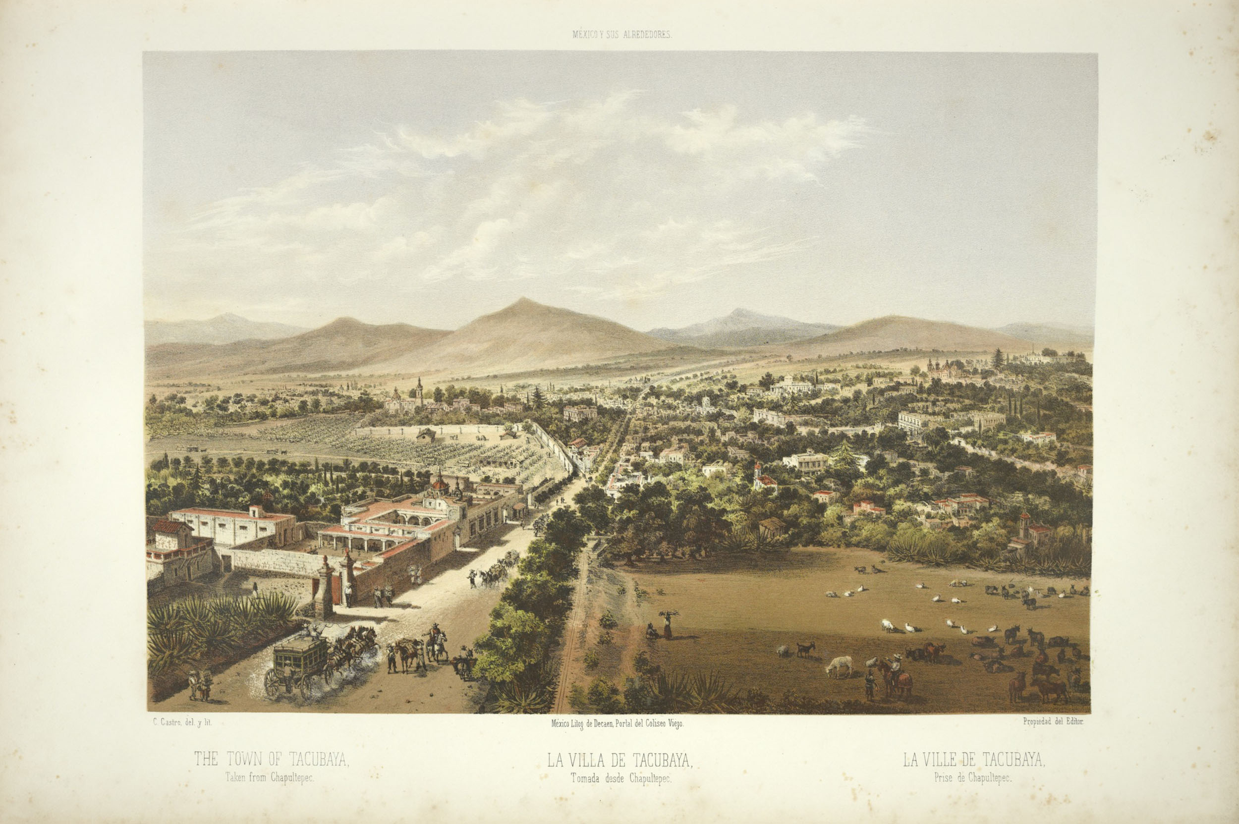
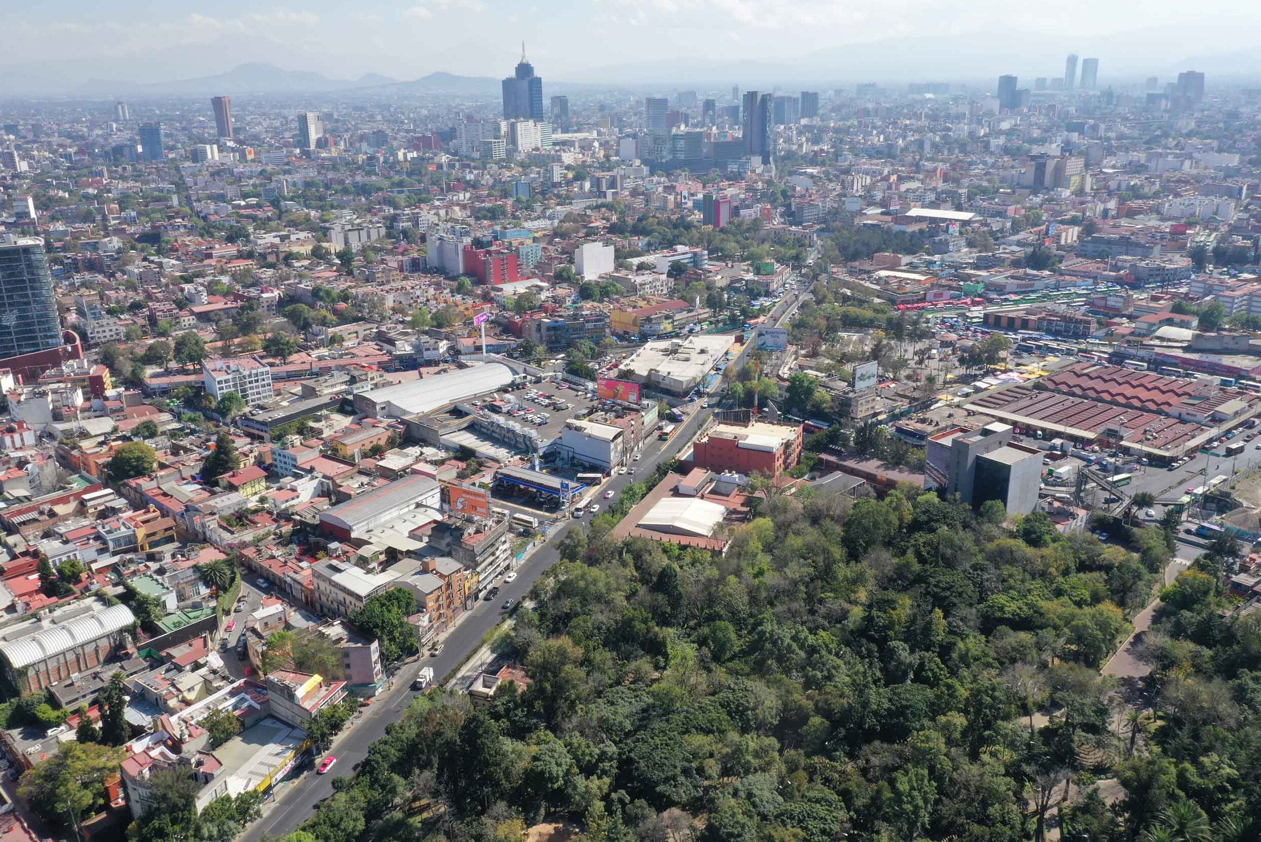
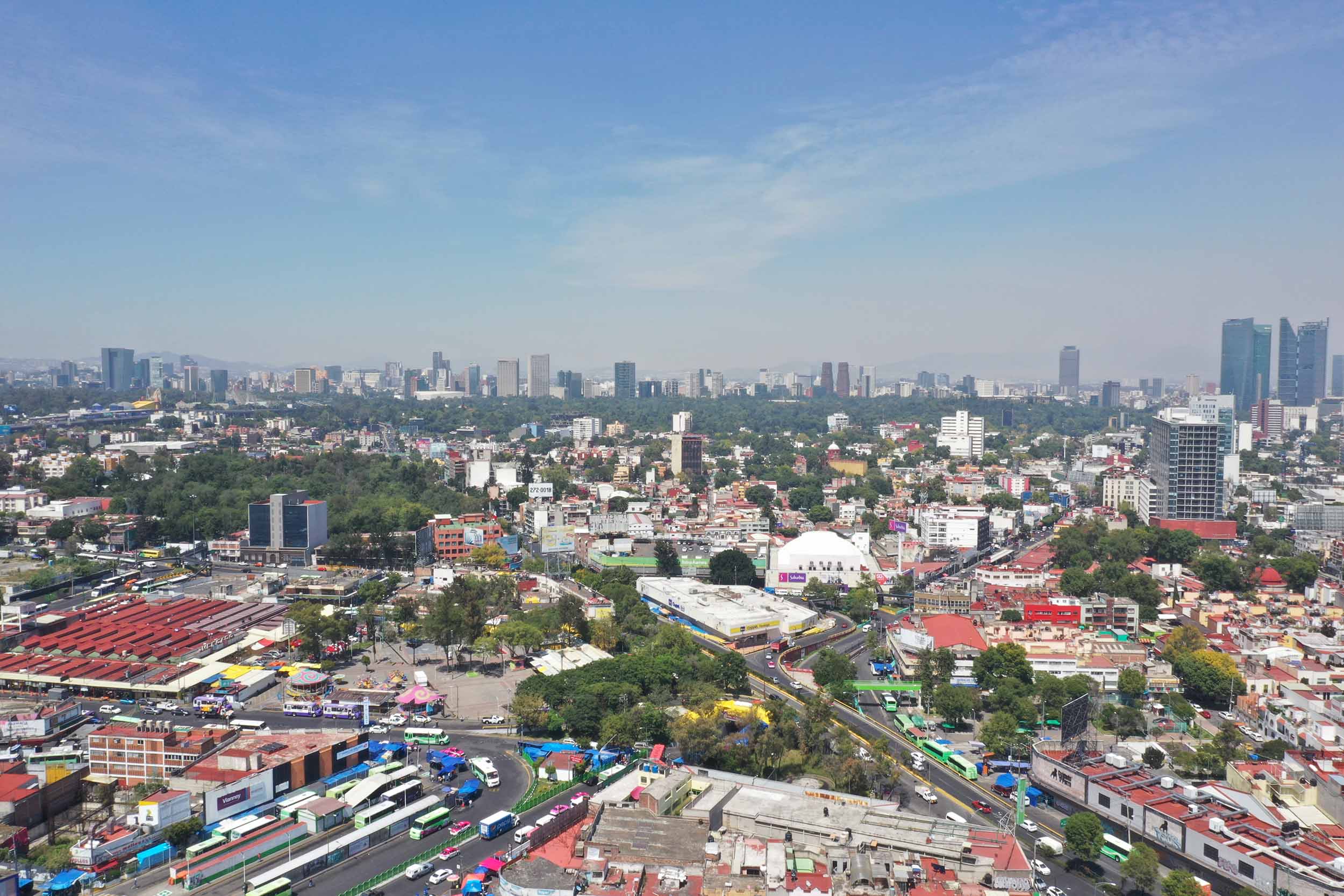
Tacubaya is a historic district within Mexico City. It was a pre-Hispanic settlement bordering a wetland, and during colonial times it became a kind of resort town for wealthy Spanish families on the outskirts of Mexico City.
The area’s growth accelerated in the 1830s and ’40s. Wealthy families began to leave Tacubaya, and the district became part of a development model that was based on subdivisions, on new lots.
The urban growth in this district picked up rapidly at the turn of the twentieth century—developers have always been interested in Tacubaya. Today, it’s where Condesa, Napoles, and other neighborhoods are located.
All this urban pressure ended up fragmenting a town that had had a very marked identity, and which is now an extremely heterogeneous urban area, with a mix of remnants of gardens, of large houses, and other typologies.
Views of Tacubaya. Image credits: Mexico Innovation Fund DRCLAS, ORU, Anita Berrizbeitia, and Mónica Arzoz
So, with the first part of our strategy—revealing the area’s history—we are trying to do justice to Tacubaya’s legacy of urban fragmentation, as it grew in an additive way, in layers and fragments. Analyzing how Tacubaya grew allows us to understand the history and the original hydrological regimes and reveal them as a relevant city layer. The idea was to rescue and highlight the system of gardens, public spaces, historical buildings, churches, observatories—an endless number of very Tacubayan historical sites.
The next approach has to do with the widening and expansion of a network of public spaces whose design tries to repair this fragmentation and incorporate multiple green infrastructure solutions to minimize the impermeable surface so that the territory can function more like a sponge and less like a giant sewer. One of the projects dealing with this theme tries to revive or rescue the Tacubaya River bed and highlight the system of gardens and squares and public spaces I mentioned.
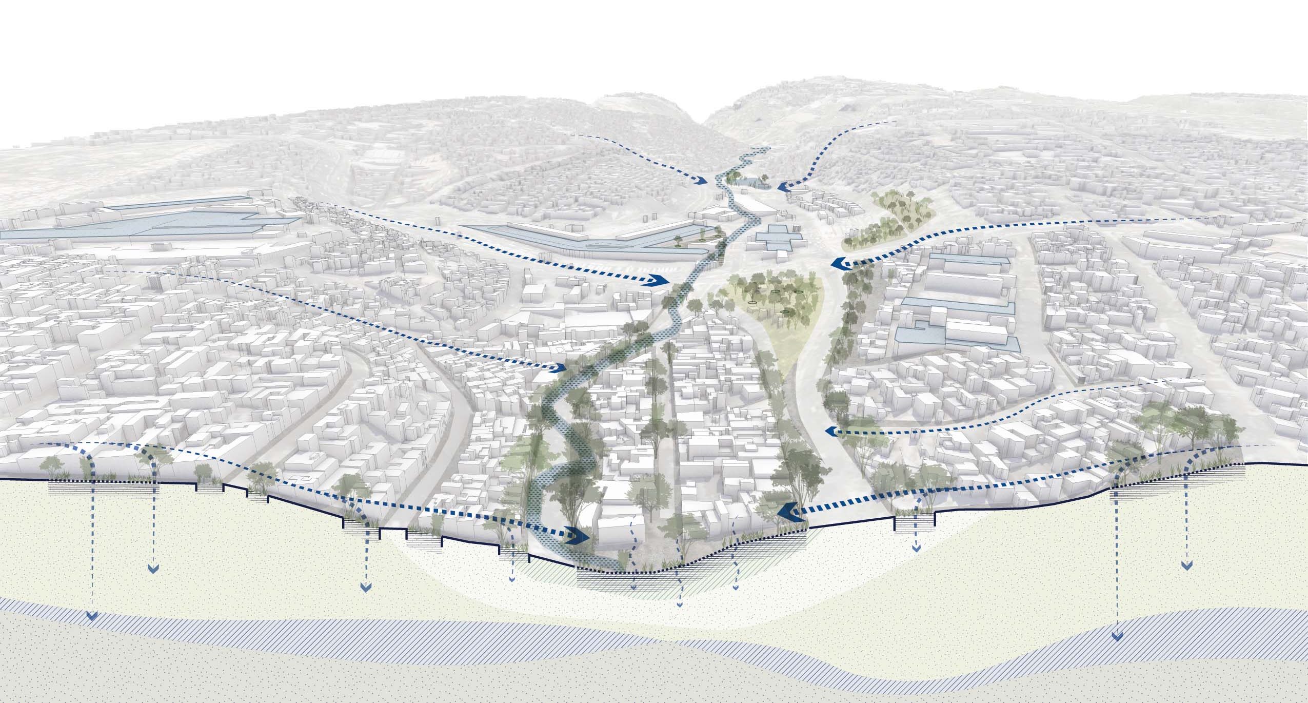
Since the 1970s, the Tacubaya River has been rerouted to subterranean tunnels beneath the neighborhood. The proposed Hydric District would reconsider the relationship between Tacubaya and its buried river, reviving the riverbed through publicly accessible green infrastructure solutions across the neighborhood. Image credit: Mexico Innovation Fund DRCLAS, ORU, Anita Berrizbeitia, and Mónica Arzoz
And obviously, the last area of focus is water: urban water as a resource, not as waste. The Hydric District is a replicable concept that breaks with the traditional model of extraction, importation, contamination, and drainage of water by proposing that water is an asset, not a waste product. This notion foresees the implementation of various strategies to capture, store, treat, and reuse water to reduce extraction and implement strategies to send water into the aquifer. We developed a framework with a system of projects for collecting, storing, treating, and reusing different types of water specifically for Tacubaya.

The Hydric District framework comprises three main elements: reveal the neighborhood's architectural and geographic history; consolidate and expand local green spaces; and treat urban water as a resource, not a waste. Areas of focus shown in the image include: 1) Tacubaya River linear park, 2) hydric and connection corridors, 3) historic buildings, 4) historic gardens and public spaces, 5) Tacubaya north–south connection project, 6) Lira Forest, 7) water treatment plants, 8) market system, 9) public facilities, and 10) new housing developments. Image credit: Mexico Innovation Fund DRCLAS, ORU, Anita Berrizbeitia, Mónica Arzoz
For example, here in Mexico people love to clean the sidewalks with potable water. But in a city with so many water pressures, it doesn’t make sense to wash sidewalks with clean drinking water. Better to wash them with water that’s already been used and appropriately treated, right?
This idea can extend to other types of uses, such as water for laundromats or car washes, and for the irrigation of this new network of public spaces that aims to reconnect the fabric of Tacubaya.
I’ll note here that this idea of the district scale is compatible with the urban instrument Adri mentioned earlier, the SAC, which seeks to create consensus between the municipal authorities and developers.
So we believe that the hydric district fits into the system by which things happen in this area, politically and financially—so there’s a congruence and a scalar compatibility between this series of urban design principles and this instrument of governance. This makes it very powerful and, well, very implementable, I would say.
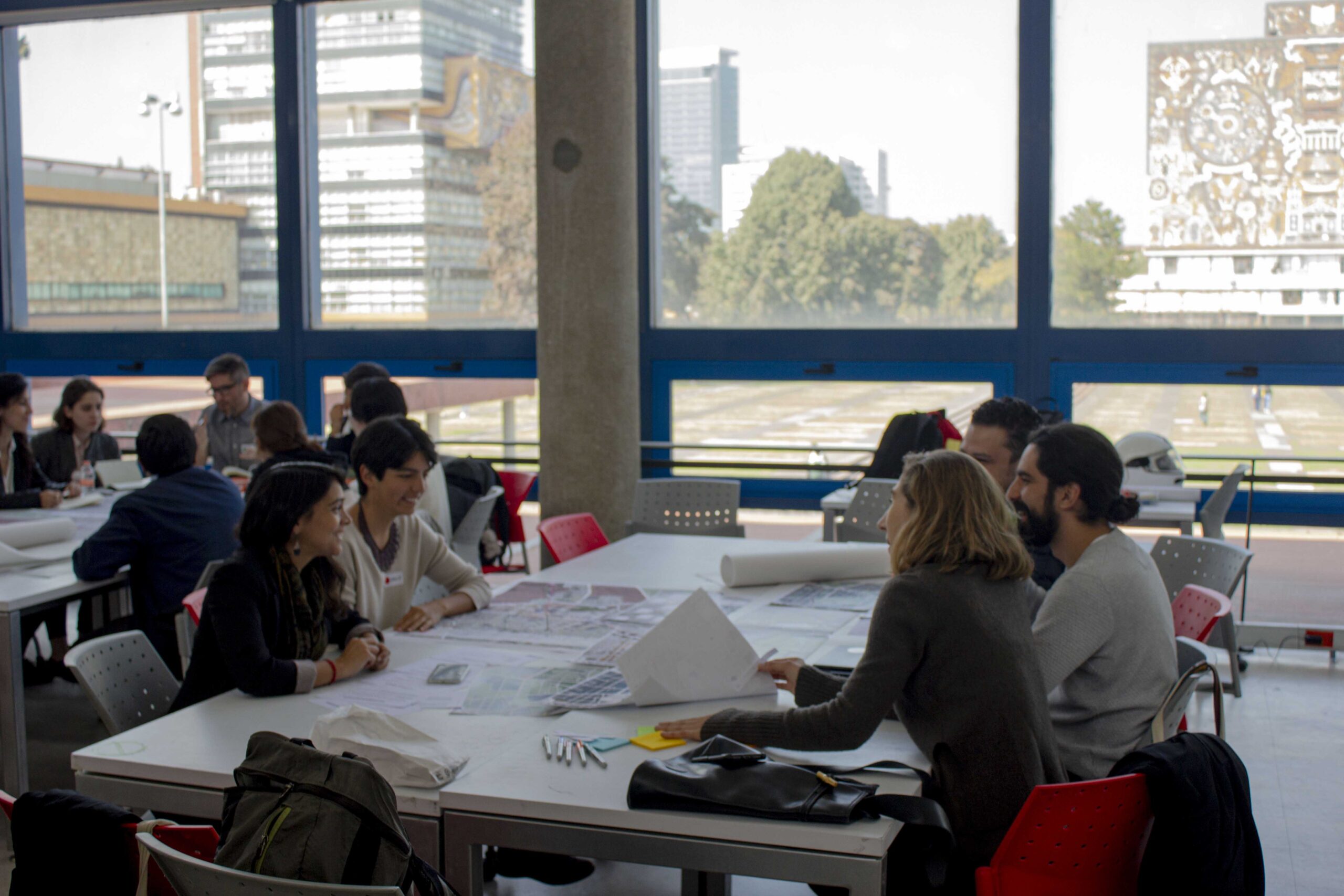
A collaborative interdisciplinary workshop at UNAM in 2020 to develop the Hydric District project proposal. Image credit: Mexico Innovation Fund DRCLAS, ORU, Anita Berrizbeitia, and Mónica Arzoz
Botero: What’s the current status of the project?
Tudela: We’re promoting it on different fronts—on one hand, through dissemination in articles and publications, and on the other hand, in academia, through teaching. We’re currently working on an online publication that will be published by UNAM this year.
The project in Tacubaya is kind of on hold for political reasons, which is very normal when it comes to processes that depend on centralized governance. So we’ll see what happens.
In the case of Coapa, we might have the opportunity to put our ideas to the test later this year through a pilot project. We’ve brought it to the attention of the water management body in Mexico City and they’re very interested. And Coapa is a zone with large infrastructural spaces—that’s to say, large roofs for capturing water, many universities, and many shopping centers. So these are ideal conditions to test the idea.
Botero: What would the first phase look like in Coapa?
Tudela: We did an analysis of all the projects that make up the district, as we did with Tacubaya. In Coapa, they have a much more severe flooding problem. So we did a very interesting geohydrological analysis to understand the potential to use the subsoil as a storage space for this water. And we’ve already verified that this is a real possibility, technically speaking and in terms of design development, since we’re working hand in hand with a university that wants to carry out an intervention in the neighborhood.
And then we’ve done mapping. We’ve identified seven projects in the neighborhood, of which we’ve prioritized two. We’re at a stage where we’re authorized to start these two projects through public engagement.
For Coapa, we think public engagement has to be the first step so that people will take ownership of the project and promote it in the subsequent phases and interventions. The site we’ve selected is a linear park that sees a lot of activity. We’re proposing to make use of the subsoil there, but also make improvements that will collect rainwater in a kind of sponge public park. So that would be our first intervention.
Wesseler: In talking to different groups of people about their needs and their issues around water, I’m sure you encounter situations where different interests butt up against one another. How do you think through these conflicts?
Tudela: Yes, there are many conflicting interests, especially in districts where there’s an appetite for development and for investment. The way we’re dealing with this, particularly in the case of Coapa, is to try to find a scenario in which all sectors involved benefit either directly or indirectly. For example, the fact that an area floods less, or has water that enables development, brings benefits to the whole area.
But the real question is not whether an area gets developed or not, but rather the way in which development is currently happening, which doesn’t reflect the opinion or the needs of all sectors. So by making room for the concerns of different parties to be considered in an open and direct way, we’re enabling an agreement to be reached about what’s worth doing.
We believe that’s the only way to operate, and so far we haven’t encountered any obstacles in terms of particular entities that don’t want to join the discussion or that want to block the proposal. Instead, the obstacles have been more about issues of time, or of political or financial processes. But in general, we’ve been very surprised that the idea has been very well received. People understand that it triggers common benefits.
In the Tacubaya Hydric District proposal, public spaces like the neighborhood market would incorporate green water management infrastructure. Image credit: Mexico Innovation Fund DRCLAS, ORU, Anita Berrizbeitia, and Mónica Arzoz
Up to now the project has focused on areas with development potential, because this makes it financially viable. But we are very interested in putting the idea to the test in more vulnerable areas, more on the outskirts.
In Mexico City, many informal settlements have been built on sloped terrain on the periphery of urban growth. If these settlements were to be paved, water wouldn’t be able to get to the aquifers that 70 percent of the city draws from. So these areas play a strategic role within the city.
For us, multiscale analysis is very important because each part of the city has a particular role or characteristic that could allow it to be resilient, but that isn’t necessarily visible today. So you can empower a community by helping residents understand their potential so that they can negotiate with the rest of the city, and thereby truly achieve urban resilience.
Resilience is not something that can be achieved street by street, but rather through a much broader understanding and dialogue. And that fact really underlies our territorial focus, in which we can be designing at different scales: from a small park, a corner, a bench, but also at a regional scale. Understanding how each part plays a role at various scales, and the connections between these parts, allows us to think in systems and processes rather than isolated objects.
Interview translated from Spanish, edited, and condensed.
Explore
The Image of Water
Communities throughout Mexico face severe challenges with water. Addressing them requires cultural as well as physical interventions, says Taller Capital.
Without Water, There Is No Growth | Cheyenne River
Lacy Maher from the Mni Wašté Water Company explains how a decade-long water shortage hindered economic growth and stopped housing development.
James Wescoat: Climate, energy, and water-conserving design
Landscape architect James Wescoat discusses water supply and other hydroclimatological conditions in major American cities.