
The dynamic shoreline of South Beach, Washington. Composite of annual Google Maps satellite views taken from 1984 to 2016. Credit: Robert Hutchison Architecture and Cory Mattheis
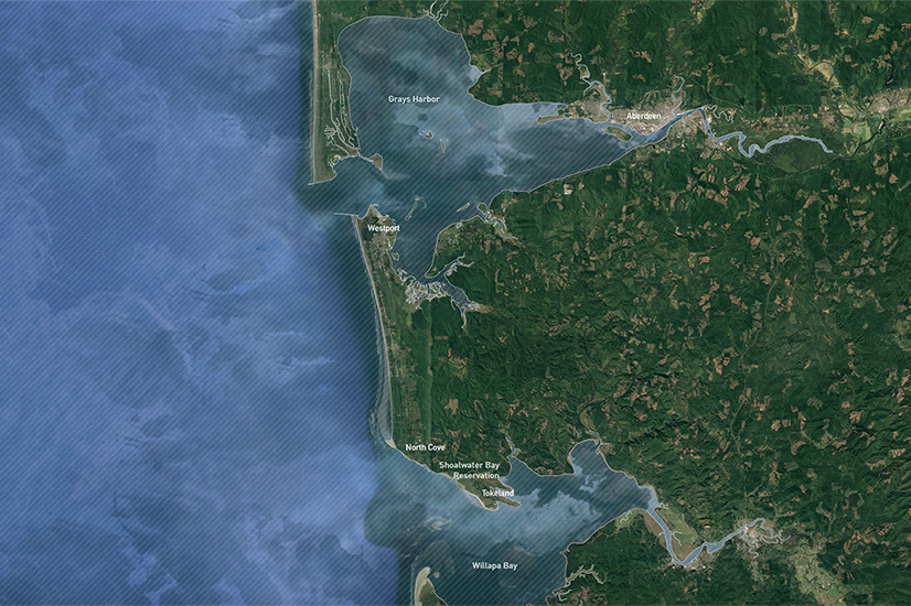
Our American Roundtable project builds upon previous engagement and work with the South Beach community located along the Pacific coast of Washington state, specifically the coastal towns of Westport, North Cove, and Tokeland. Each of the three communities differs in its demographics, population, and geography. The city of Westport, situated on a peninsula that separates Grays Harbor bay from the Pacific Ocean, is home to the largest marina on the outer coast of the US Pacific Northwest, with a large commercial fishing fleet and a Coast Guard station. Unincorporated North Cove, a beach community located between State Route 105 and the Pacific Ocean, has earned the nickname Washaway Beach due to the extreme coastal erosion that occurs on an annual basis. Unincorporated Tokeland, situated on a narrow peninsula that separates Willapa Bay from the Pacific Ocean, is home to the Shoalwater Bay Tribal Reservation, Tribal Complex, and Casino. Our project provides a portrait of South Beach that reveals the community’s intimate, and at times perilous, relationship with the sea.
South Beach, Washington. Credit: Robert Hutchison Architecture
South Beach stretches between Grays Harbor and Willapa Bay—the two largest bays on Washington State’s Pacific coast—and straddles Grays Harbor and Pacific Counties. It includes the Shoalwater Bay Indian Reservation (population 70), the incorporated municipality of Westport (population 2099), and the unincorporated towns of Ocosta, Bay City, Laidlow, Cohassett Beach, Grayland, North Cove, and Tokeland, among other small settlements. The towns are linked by a single highway, State Route 105, and they share infrastructure and services, including a regional school district and fire district.
A case study of the South Beach community yields valuable perspectives on the current condition of small coastal towns; their challenges and opportunities related to the important connection between place and ecology; and the daunting yet certain future of sea-level rise and a Cascadia Subduction Zone tsunami.
The communities also share a deep connection to the local ecosystem, exemplified by their long history of logging, fishing, shellfish harvesting, cranberry cultivation, hunting, and foraging. Their connection to ecology remains vital and formative, resulting in a deep and complex emotional identification with place that no longer exists in regions where historical ties to nature have withered.
Most dramatic among the stories that South Beach brings to American Roundtable is its extreme environmental dynamism, expressed in phenomena occurring on widely varying time scales.
At one temporal extreme is North Cove’s Washaway Beach, the fastest-eroding section of the entire US west coast. There, the shoreline has retreated an average of 100 feet per year for the past century due to a complex mix of ocean currents, wave action, sediment transport, and the shape of the land itself.1B. Talebi, G.M. Kaminsky, P. Ruggiero, M. Levkowitz, J. McGrath, K. Serafin, D. McCandless, “Assessment of Coastal Erosion and Future Projections for North Cove, Pacific County,” State of Washington Department of Ecology Publication 17-06-010 (June 2017): 2.
At the other extreme are rare but powerful megaquakes and tsunamis that transform great stretches of coast along the Cascadia Subduction Zone (CSZ) from Northern California to British Columbia. Of all the subduction zones around the Pacific Rim of Fire, the CSZ is the quietest. It ruptures only every 250 to 500 years, in 8.0- and 9.0-magnitude earthquakes that raise or drop the land as much as six feet, and generate tsunamis more than five stories tall that can reach the shore in as little as 15 to 20 minutes. The last such event was in 1700; we are within the historic window for the next one.2B.F. Atwater et al., The Orphan Tsunami of 1700: Japanese Clues to a Parent Earthquake in North America (Reston, VA: United States Geological in association with Seattle, WA: University of Washington, 2005): 9.
Most current settlements are built on low-lying sand spits. Following such a powerful earthquake and rapid-onset tsunami, survivors would be able to evacuate only on foot. With no natural high ground for them to run to, costly vertical evacuation strategies present the only viable option to provide refuge.
The enormous changes CSZ events bring to the coastline became known to modern science only about 40 years ago, but they have been a subject of Indigenous ecological knowledge for generations. Indeed, it is the CSZ’s tectonic processes, in combination with the temperate rainforest climate, that has made the Pacific Northwest coastal environment so supportive of life for both the Indigenous people who lived sustainably there for thousands of years and the settlers who came to log, farm, build, and exploit the natural bounty at a much faster rate.
But now even the climate is changing. The estuarial bays with their shellfish beds that bracket the South Beach section of coast, the razor clam beds on the ocean beaches, the fisheries offshore, and the blufftop forests are all experiencing the effects of rising temperatures and sea levels, ocean acidification, changes in precipitation patterns, and increasing frequency and severity of storm and king tide flooding. Even wildfires—nearly unheard of in the wet coastal rainforests—have begun to appear in the region.
When faced by existential threats that are unprecedented or too rare to have been experienced in living or recorded memory, people draw strength, resilience, and resourcefulness from the way they meet more common and ongoing challenges. South Beach has many of both kinds of challenges, and its residents have responded to them with an inspiring mix of individual creativity and perseverance, as well as collective commitments to community survival.
From a national perspective, no accomplishment demonstrates community multigenerational commitment more dramatically than the locally funded construction of North America’s first tsunami vertical evacuation structure at the Ocosta public school. The project was so advanced that no federal program existed to fund it, and so the school district paid for it with a local tax levy.3T.J. Walsh, John D. Schelling, C.R. Ash, R.J. LeVeque, L.M. Adams, F.I. Gonzales, The First Tsunami Vertical Evacuation Structure in the United States: Ocosta Elementary School, Washington, poster presented at GSA Annual Meeting, 2014. Also see S. Doughton, “‘It will happen here’: Washington Coast school builds nation’s first tsunami refuge,” Seattle Times, June 9, 2016.
Today, largely due to the Ocosta School’s proof of concept, the Federal Emergency Management Agency administers a program to subsidize structures that can function as tsunami vertical evacuation sites. The second of such structures to be built in Washington is also in South Beach, by the Shoalwater Bay Tribe at Tokeland, and the City of Westport has received a FEMA grant to begin development of a third.
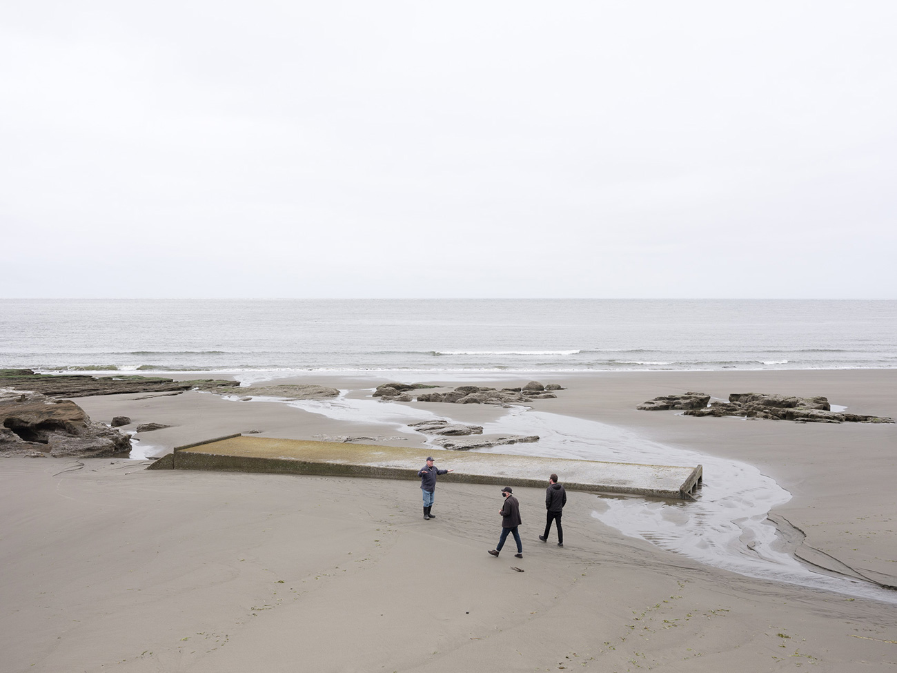
Near Shoalwater Bay Reservation, North Cove, Washington. Credit: Eirik Johnson
Our engagement with South Beach is part of an ongoing effort to learn from these accomplishments, and to relate them to what we have observed of coastal hazards resilience in Japan and elsewhere on the Pacific Rim of Fire. Daniel Abramson’s role in this effort, which has been supported by the National Science Foundation and the Bullitt Foundation, has involved community charrette–style workshops that have informed resilience-oriented policies and investments.4D. Abramson, C. Depari, C. Dohrn, F. Gonzalez, K. Idziorek, P. Jalali, L. Keber, R. LeVeque, S. Nelson, L.T. Nguyen, S. Sreenivasan, H. Stanton, Y. Zhang. “Localizing Hazard Mitigation: Recommendations for Westport’s Comprehensive Plan Update” (Seattle, WA: University of Washington Institute for Hazard Mitigation Planning and Research, 2018). H. Stanton, “Integrating Hazard Mitigation Strategies into the City of Westport’s Comprehensive Plan Update” (Thesis, University of Washington, 2019). Robert Hutchison’s recent research, influenced by his 2019 visit to the Sendai region of Japan as a UW Runstad Fellow, has focused on how communities prepare for future earthquake and tsunami disasters, as well as how they cope in the aftermath of a disaster.5See Robert Hutchison’s interview with architect Osamu Tsukihashi: Robert Hutchison, “The Lost Homes Project: An Interview with Osamu Tsukihashi,” Arcade Magazine 38, no. 1, ‘Phase Shift’ (Summer 2020): 14-16.
Findings from our collective research and investigations suggested one question in particular that led us to this American Roundtable project: When preparing for uncertain but existentially threatening future changes, does it help a community to reflect on the changes and challenges it has already weathered, and the values it has thereby forged? We think the answer is yes. This American Roundtable community portrait is an effort to capture broadly some of what we have learned from the landscape and people of South Beach that may be most inspiring and useful to the community’s pursuit of resilience.
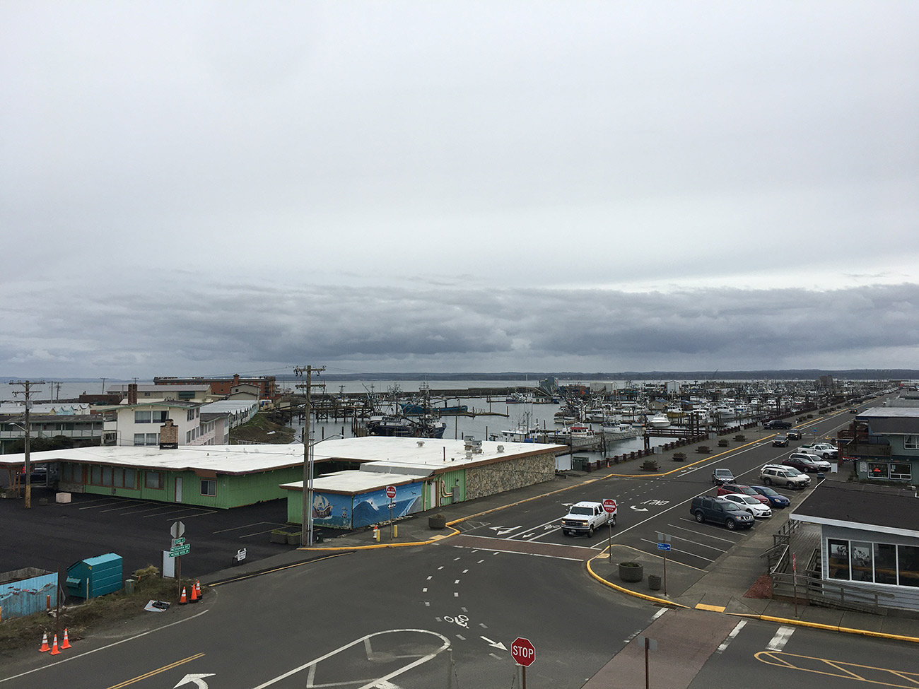
Westport, Washington. Credit: Robert Hutchison
To do this, we brought together a group of contributors with diverse backgrounds: a photographer (Eirik Johnson), landscape architect (Barbara Swift), architect (Cory Mattheis), professor of law (Gregory Hicks), and land-use policy and community programming expert (Skip Swenson).
Barbara Swift’s essay on coastal ecology first discusses the deep environmental foundation of South Beach’s place identity, followed by Skip Swenson’s description of how people in the community have made their livelihoods on this foundation. Cory Mattheis’s contribution, with assistance from Robert Hutchison, focuses on infrastructural interventions in South Beach’s dynamic landscape, as efforts by the community to support its livelihood and survival, which Greg Hicks then also addresses from a social perspective, focusing on health and wellbeing as a broad cultural response to coastal dynamism and historical and environmental trauma. Eirik Johnson’s beautiful photographs of the region help illustrate these contributions, and also bracket them with standalone photo essays that serve as Prologue and Epilogue for our portrait of South Beach.
Biographies
Robert Hutchison
is a practitioner, researcher, and educator whose interests and practice overlap the fields of architecture, installation, and photography. He is principal of Robert Hutchison Architecture, and an affiliate associate professor in the University of Washington Department of Architecture, where he teaches undergraduate and graduate studios. In 2018, Hutchison led a multidisciplinary group of architecture, landscape architecture, and planning students to speculate the future of Mexico City, specifically related to the themes of water, seismology, infrastructure, and inequity. Since March 2019, when he traveled to the Sendai region of Japan as a UW Runstad Real Estate Fellow to study the topic of earthquake and tsunami resiliency, Hutchison has been researching the state of emergency preparedness for communities along the Pacific coast of Washington state that are subject to tsunami inundation. Honors include a 2017 Rome Prize from the American Academy of Rome and a 2009 Emerging Voice award from The Architectural League. Most recently, Hutchison was selected as a 2020–21 Creative Artist Fellow by the Japan–US Friendship Commission. For this fellowship, he plans to travel to Japan in 2021 to study the relationship of recently constructed tsunami infrastructure to small communities along the Tohoku coastline of Japan.
Daniel Abramson
is an associate professor in the University of Washington’s Department of Urban Design and Planning. His research focuses on community resilience and adaptive planning in disaster recovery and hazard mitigation, and he has taught multidisciplinary studios integrated with scientific research on new protocols for state agencies and communities to envision hazards-resilient development on the Washington coast. This community-engaged research incorporates the latest science in localized seismic, tsunami, and sea-level-rise modeling and risk communication into practical community planning and urban design. South Beach, including the City of Westport and the Ocosta School District with North America’s first tsunami vertical evacuation structure, are among the current local partners in the project. Abramson is now lead principal investigator in a new National Science Foundation Coastlines and People (CoPe) project, working to develop geo-narratives that leverage scientific advances in modeling of hazardous geo-environmental processes, as well as local community history and understanding of hazards. Japanese and Chilean collaborators in this work are also helping to bring lessons of recent subduction zone megaquake and tsunami disasters around the Pacific Rim to Washington state, and to inspire our international partners with this example of American small-town pro-active spirit and long-term environmental thinking.
The views expressed here are those of the authors only and do not reflect the position of The Architectural League of New York.