Your Land: The Transformation of Public Spaces in West Virginia
Merritt Chase discusses three projects rethinking public space across different scales.
What defines public space in West Virginia? In a rural state where less than 8 percent of the land is considered developed1United States Department of Agriculture, Natural Resources Conservation Service, 2017 Natural Resources Inventory, “West Virginia Land Use.” Learn more. and almost 70 percent is forested, public spaces operate on different scales. From regional conservation initiatives to multi-county trail systems and neighborhood parks, outdoor public spaces help make West Virginia’s communities lively and diverse.
Collectively, there is power and value in these landscapes, which layer history, culture, and ecology to improve quality of life, celebrate cultural identity, and inspire a sense of community. Across West Virginia, residents and advocates are investing in both rural and urban landscapes, leveraging the state’s greatest asset—its public land2Approximately 20 percent of the state’s land is public, owned by either city, state, or local government.3Barbara Rasmussen, “Land Ownership,” in e-WV: The West Virginia Encyclopedia, West Virginia Humanities Council, 2006; online ed., 2010–.—to become the foundational building block of its communities.
The following projects offer perspectives on how public spaces support the region’s future, foregrounding landscape as the medium to celebrate West Virginia’s unique identity. The selected projects illustrate three scales of public space. The Monongahela National Forest in eastern West Virginia offers an example of large-scale preservation and conservation efforts, while the Hatfield-McCoy ATV Trails System illustrates a multicounty-scale effort to attract tourism to the state’s southern former coalfields. The recent renovation of the Hazel Ruby McQuain Riverfront in Morgantown provides a replicable example of how design partnerships and community-led master planning created citywide benefits by means of investment in a site-scale riverfront park.
The Monongahela National Forest: Conservation Inspiration for West Virginia's Future
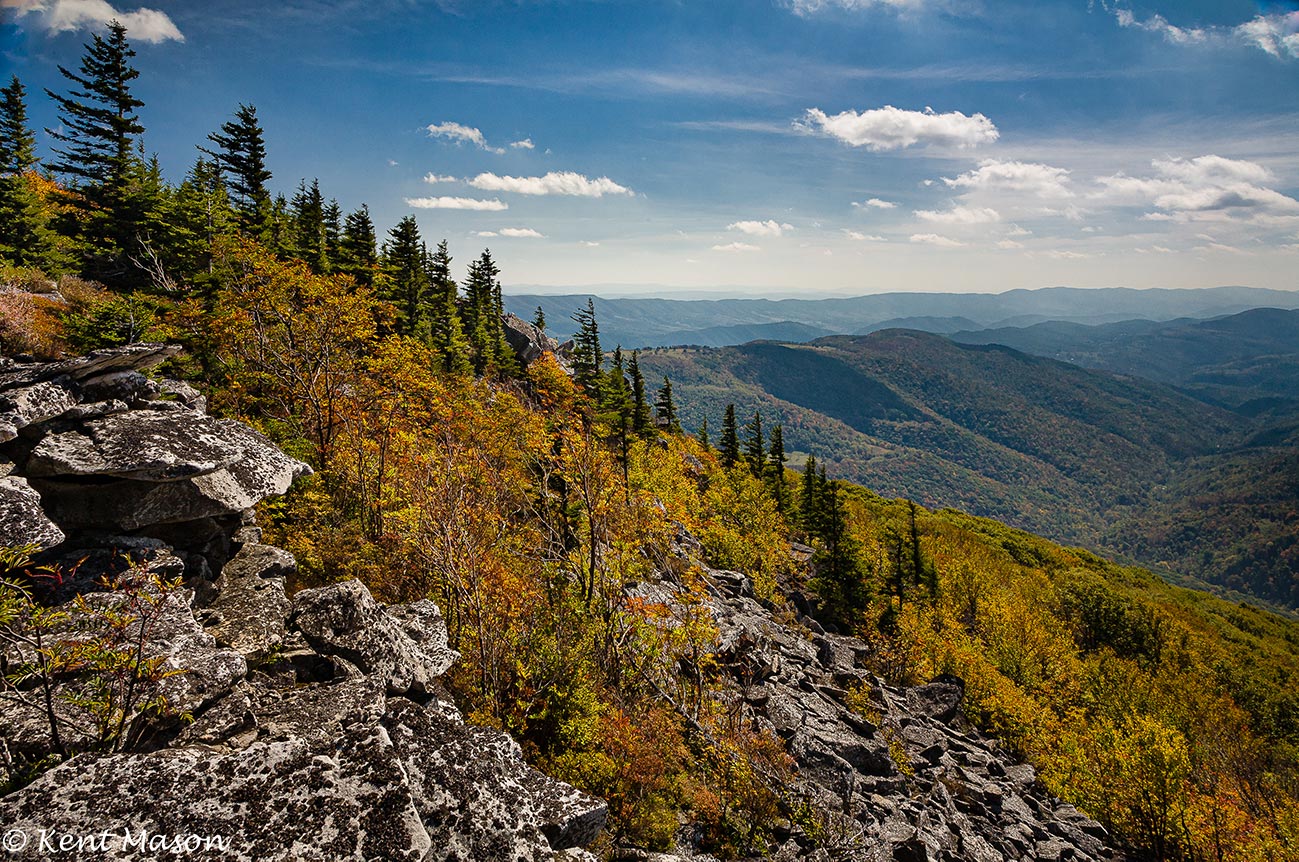
Monongahela National Forest. Credit: Kent Mason
The Monongahela National Forest is located in the Allegheny Mountains of eastern West Virginia. Composed of 1.7 million acres of land, 54 percent of which is currently federally owned, the forest includes major landscape features such as the Allegheny Front, the Ridge-and-Valley Appalachian Mountains, and Spruce Knob, the state’s highest elevation point. Located within a three-hour drive from Washington, DC, the national forest is a significant and publicly accessible destination for recreational tourism. Extensive backwoods roads and trail systems support recreational activities including hiking, mountain biking, horseback riding, camping, hunting, and fishing.4Learn more.
In the past five years, West Virginia’s recreation and tourism industries have been on the rise. In 2018, the state welcomed 65.5 million visitors; during that year, tourism generated $4.6 billion in revenue (thanks in part to a 10 percent surge in traveler spending compared to 2016) and supported 45,400 jobs.5West Virginia Tourism Office, “2019 Annual Report.”
Today, the Monongahela National Forest attracts more than 1 million visitors each year and is home to some of the most biodiverse ecosystems in the country. Because of its proximity to major cities along the Eastern Seaboard, the forest is accessible by car to more than half of the nation’s population.6United States Department of Agriculture, Forest Service (website), Monongahela National Forest, About the Forest. Not only is it a source of pride for West Virginians, the forest now contributes significantly to the local and state economies.
The Monongahela National Forest is teeming with wildlife, diverse tree species, and active waterways. To the untrained eye, its woodlands, ridges, and valleys feel untouched. Yet 100 years ago, the land looked very different. A majority of the trees had been logged for timber and the privatized land had been mined for coal. Hillsides were left barren and the rivers polluted. Today, thanks to large-scale federally funded conservation efforts, most of these lands have been returned to the public with restored, diverse ecosystems and second-growth forests.
The establishment of public land and resulting restoration of the Monongahela National Forest was spurred by local and federal programs in the 1930s that brought together a labor force dedicated to the protection and regeneration of the natural environment. The 1911 Weeks Act allowed for public land conservation, enabling more than half of West Virginia’s Civilian Conservation Corps to expand the Monongahela National Forest edge to include most of the state’s eastern boundary. The Civilian Conservation Corps program employed 55,000 people in West Virginia between 1933 and 1942, aiding in both economic recovery and resource preservation. The workers planted millions of new trees, restored native habitats, and built infrastructure and recreation areas that are still used today.
West Virginia’s public lands are evidence of the success of large-scale efforts devoted to the restoration of the natural environment. Not only were forests and streambed ecosystems revived, but West Virginia workers were able to earn a living wage and form a cultural foundation for the state’s recreational assets.
These reinvestment strategies are still applicable today. Policies outlined in the Green New Deal—including sourcing 100% of the country’s power from clean, renewable, zero-emission energy sources while providing high-quality job training, promoting economic development, and growing domestic manufacturing—highlight the potential for land-based industries to restore ecosystems while providing jobs and new economies.7Recognizing the duty of the Federal Government to create a Green New Deal, H.R. 109, 116th Congress (2019).
Continued land reclamation and conservation, coupled with growing local and national enthusiasm for West Virginia’s public lands, presents a multi-faceted opportunity for the state’s public spaces. Given its history of large-scale forest restoration, West Virginia’s regional parks are uniquely positioned to host continued reclamation programs. Looking toward a future for West Virginia, the Monongahela National Forest’s beginnings as a vast restoration and conservation strategy that supported local West Virginians represents a replicable playbook to reignite local economies and reframe the role land plays in the state’s identity.
Hatfield-McCoy ATV Trails: Public–Private Recreational Landscapes
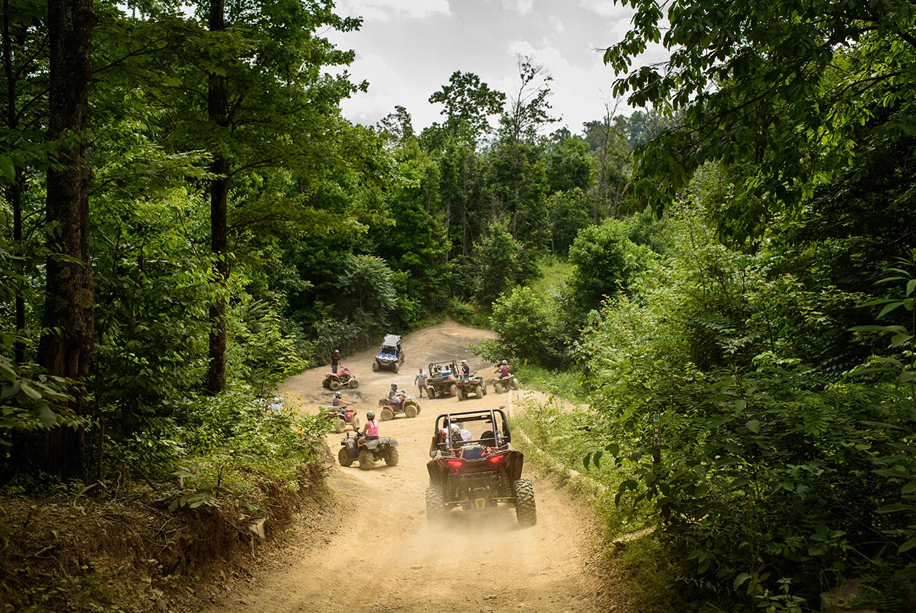
The Hatfield-McCoy ATV Trails. Credit: Rebecca Kiger
West Virginia’s vast and unique trail networks navigate the state’s complicated terrain and waterways, providing access to both public and private land across the region. With more than 5,500 miles of publicly accessible trails, nearly every county in the state has access to hiking, biking, kayaking, backpacking, horseback riding, and ATV (all-terrain vehicle) riding.8Learn more. At a national scale, West Virginia’s trails are noted for their diverse ecological display, as well as their connections to American history. At a local scale, trails are increasingly becoming a means to uplift local economies and connect West Virginia counties with one another.
Traditional trail networks include hiking trails, rails-to-trails walking and biking trails, and water trails. Recently, less-traditional ATV trail networks have become notable economic and cultural destinations. The Hatfield-McCoy ATV Trails System, a multi-county trail network, attracts substantial tourism to West Virginia’s former southern coalfields and has become the poster child of a new recreational industry. While numerous key hiking and biking trail connections remain incomplete, multipurpose trail networks continue to provide increased access throughout the state. Approximately 560 miles of abandoned rail lines previously used for industrial transportation have been converted to walking and biking trails,9Learn more. offering gentle grades and wide egresses. Water trails along rivers, streams, and creeks provide aquatic access for canoers, kayakers, and paddle boarders.
The trail networks have been made possible by extensive resident-led, grassroots efforts to capitalize on existing rail and utility corridors and former mine lands for recreational futures. These efforts have succeeded thanks to a variety of public and private partnerships and the negotiation of complicated land agreements and easements. Private organizations such as the West Virginia Trails Conservancy and the Kanawha Trail Club have worked to manage large trail systems, facilitating agreements between private landowners and state and city agencies to allow public trail access.
The Hatfield-McCoy Trails System has been lauded as a particularly successful example of how public–private partnerships can enable novel ATV trail recreation on former mine lands. The Hatfield-McCoy Regional Recreation Authority (HMRRA), a public entity, has entered into partnerships with over 300 landowners to gain access to more than one million acres of land. Utilizing a variety of funding streams, including the Abandoned Mine Lands Reclamation Fund, the Hatfield-McCoy Trails System has grown over the last 20 years to include more than 700 miles of ATV, utility vehicle (UTV), and off-road motorcycle trails.10Emily Allen, “Hatfield McCoy Trails Bring Tourism to Southern West Virginia (And Need for Lodging),” West Virginia Public Broadcasting, November 1, 2019. In addition to managing land ownership and trail operations, the HMRRA works with local residents to provide resources enabling alternative economic opportunities through small business ownership and a culture of entrepreneurship. As the number of trail visitors continues to rise (55,000 permits were sold in 2019), so has the demand for associated products and industries, from riding gear to hotel accommodations, spurring new local economies.
The growth of recreational tourism along trail networks across the state has been led by West Virginians seeking to highlight the region’s history and environmental assets. Creative land agreements and public–private partnerships can continue to provide models for new public space access across the state.
Hazel Ruby McQuain Riverfront Park: Design-Driven Riverfront Revitalization

West Virginia’s rivers and public riverfronts have undergone dramatic transformations in recent years. Historically used for industrial transportation, the state’s waterways are now increasingly used for recreation and entertainment. Across the state, communities are recognizing the cultural and economic potential of these public landscapes by constructing parks, increasing boat access, and connecting riverfront trails. Designers, and specifically landscape architects, can play a prominent role in the equitable realization of these public spaces. With the ability to convene community members and layer history, culture, and ecology into creative design solutions, landscape architects can ensure that waterfront projects are sensitive to their contexts and reflective of their communities. The recent renovation of Hazel Ruby McQuain Riverfront Park in Morgantown, West Virginia, provides a regional precedent for how successful partnerships between designers and community members have resulted in a transformed public riverfront park.
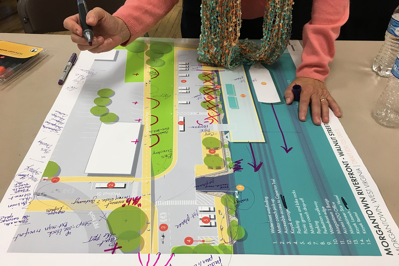
Located along the banks of the Monongahela River, Hazel Ruby McQuain Riverfront Park was built in 1999 and designed to connect adjacent bike trails and host community events. Over the years, lack of funding for maintenance and low capacity for programming led to a gradual decline in the park’s condition. In early 2016, local advocates began to imagine the future of the park and engaged landscape architect and former Morgantown resident Nina Chase (the editor of this report) to spearhead early design-focused efforts to build momentum for riverfront park improvements. Chase, along with the City of Morgantown and civic and environmental organizations Riverlife, the Northern Brownfields Assistance Center, and the Mon Rivertowns Program, hosted community workshops, encouraged a larger master planning process, and visualized design options that resulted in park funding from the Hazel Ruby McQuain Charitable Trust.

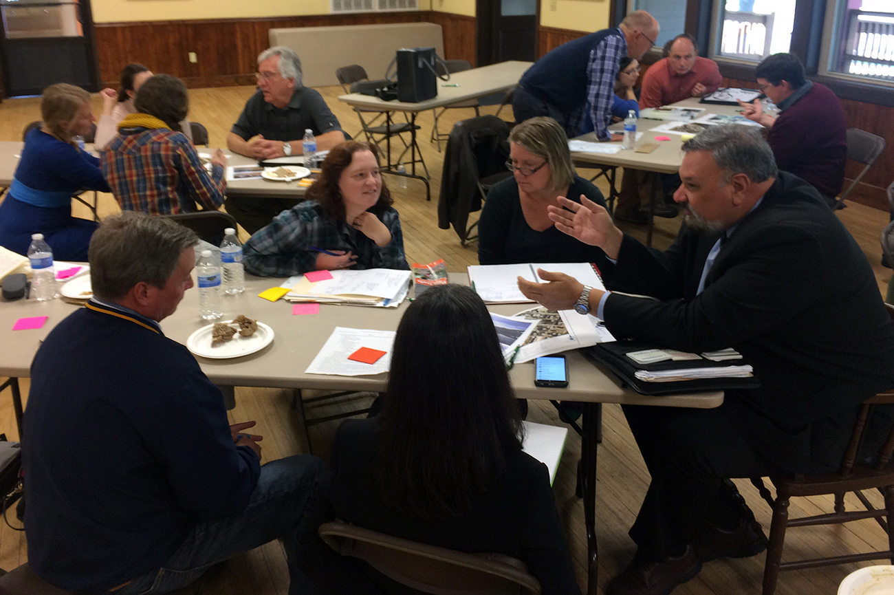
To provide continued advocacy for riverfront improvements, local advocates formed the Morgantown Riverfront Revitalization Task Force. Anna Withrow Leisher, a landscape designer and the inaugural chair of the task force, worked to facilitate an inclusive community process.
“The park is a very important place to a very diverse set of stakeholders and community players. The design was informed by a thorough engagement process,” she described in an email. “From the site furnishings to the native plantings and the recreational amenities, the park is the result of a collaborative and iterative process. Although not a quick or simple process, this engagement model is how to build a well-used and well-loved community space.”
The renovation of Hazel Ruby McQuain Riverfront Park provides replicable lessons for river towns interested in investing in their public spaces. Throughout the process, designers and advocates participated in group site visits and public workshops to identify opportunities and constraints, assess regional riverfront resources, and design park amenities that leveraged community-need and available funding sources. This holistic master planning process set the groundwork for community engagement, leading to a shared, cohesive vision for implementation.
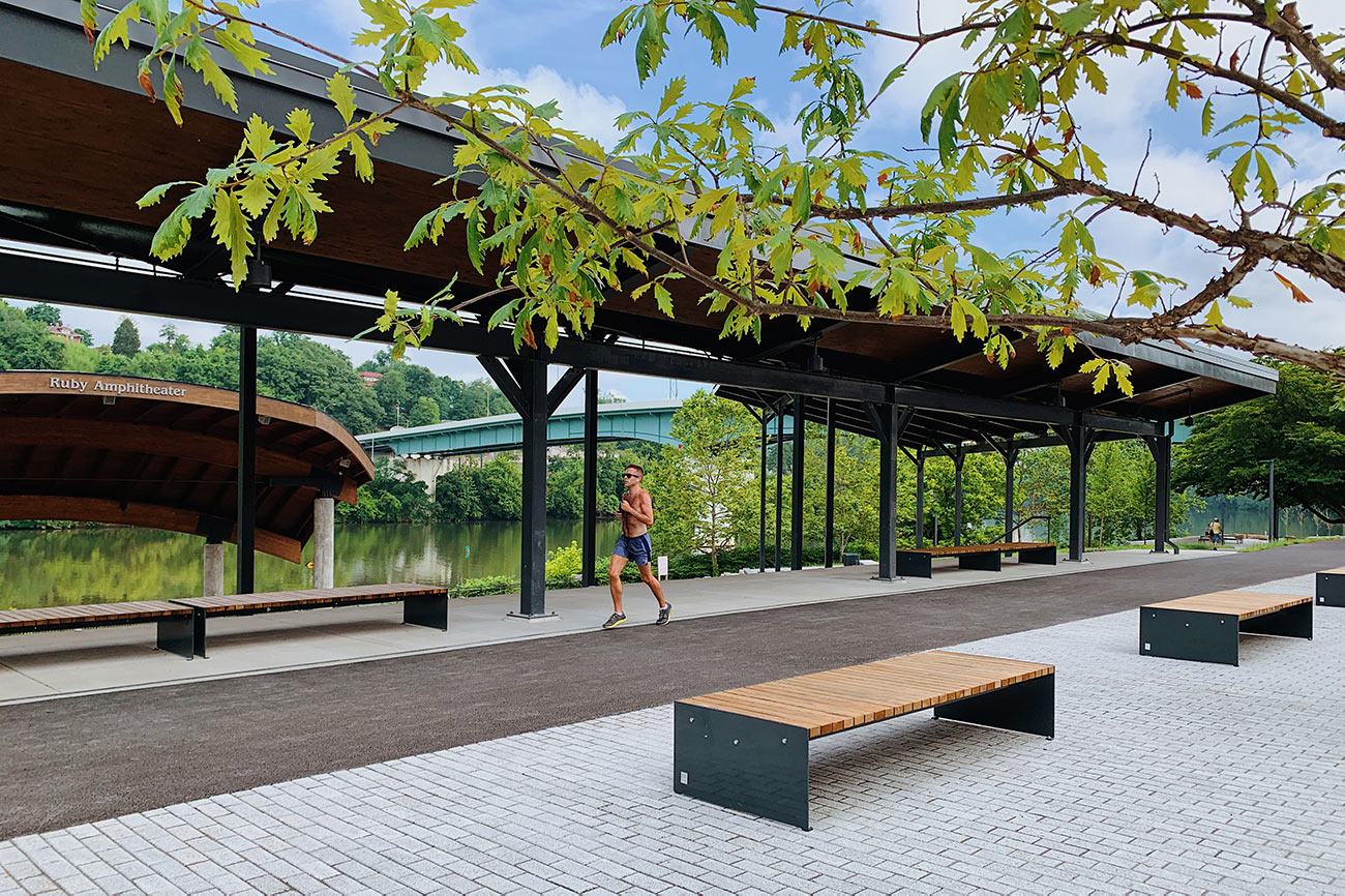
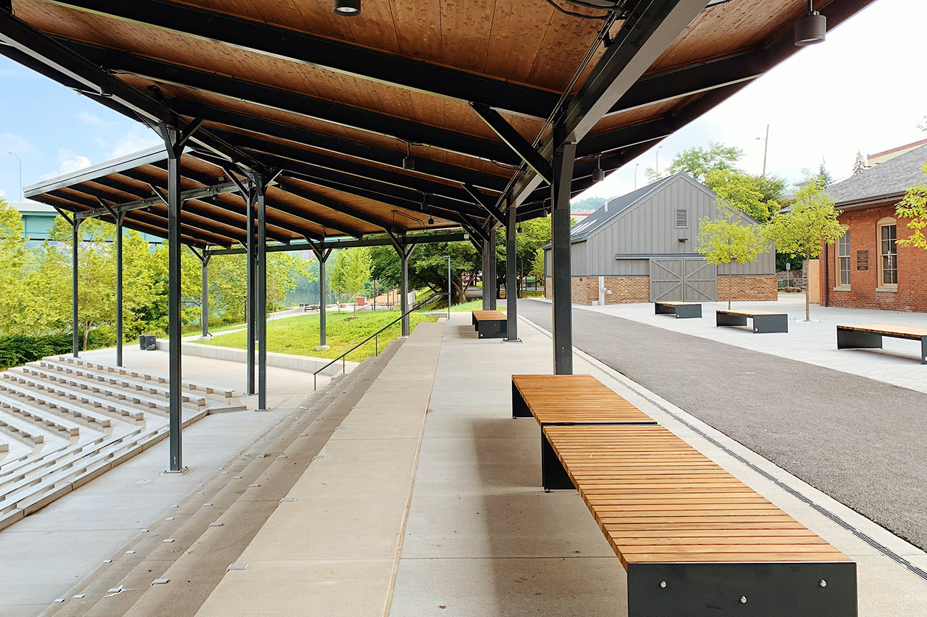
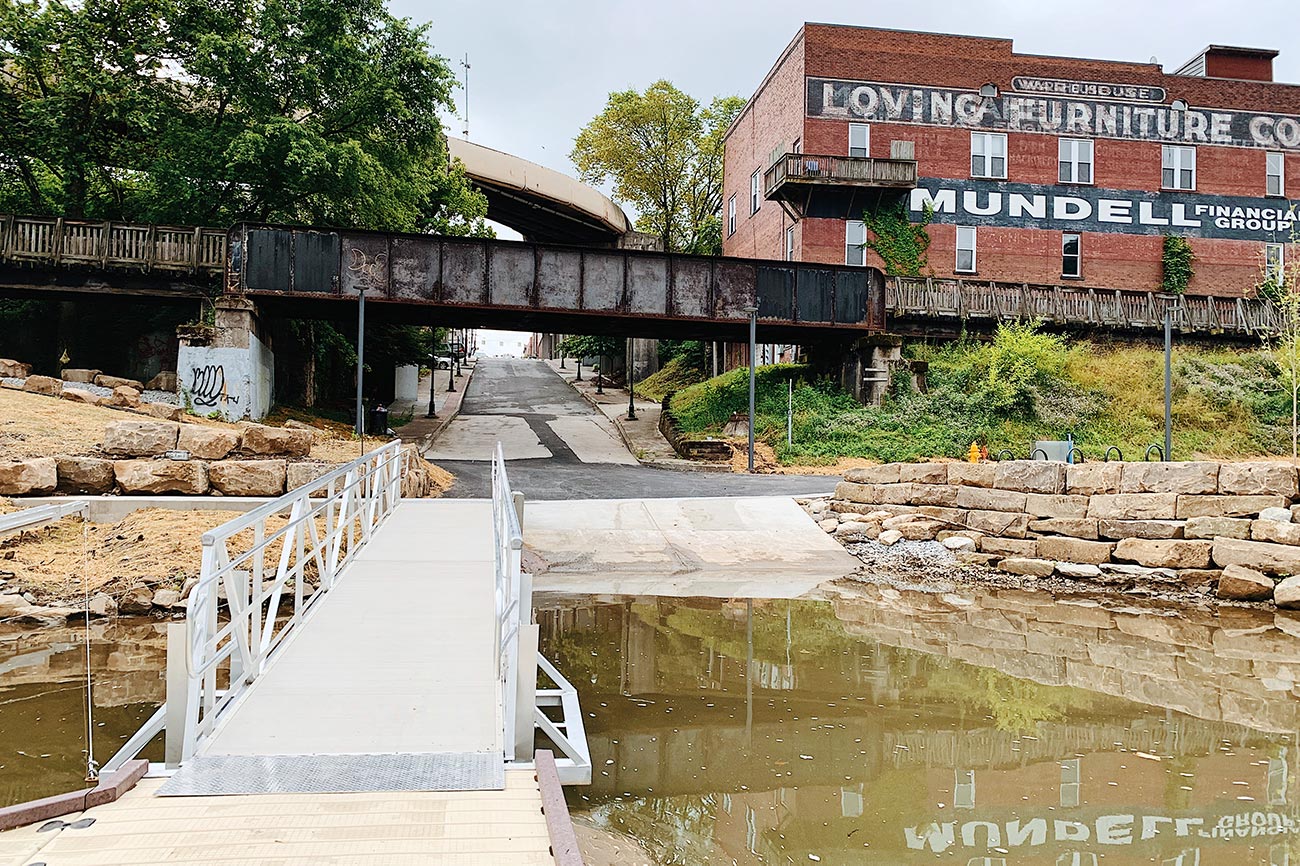
Community advocates, city staff, nonprofit partners, funders, and designers worked together to refine park concepts, create a final phased master plan, and ultimately procure the services of the design and construction team through a public request for proposal (RFP) process. The landscape-led team selected through the RFP included Merritt Chase, Strada Architects, Thrasher Engineering, and March Westin. The renovation of Hazel Ruby McQuain Riverfront Park was completed and open to the public in the summer of 2020. The project included significant updates to Ruby Amphitheater, a realignment of the Caperton Rail-Trail, the renovation of the historic Morgantown train depot and plaza, and a new boat ramp with an ADA accessible kayak launch and kayak storage lockers. In addition to physical improvements, recurring funding supports a full-time program manager hired through the City of Morgantown.
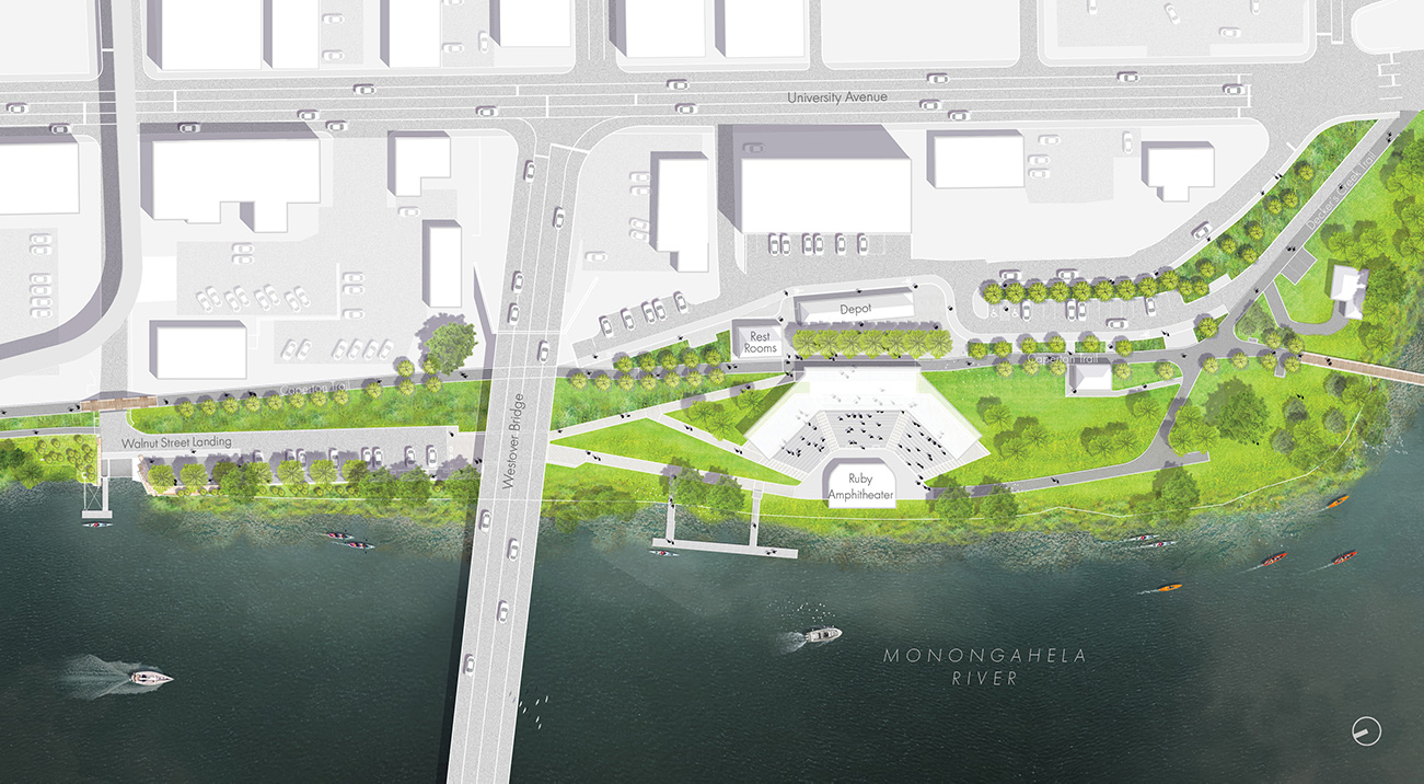
Hazel Ruby McQuain Riverfront Park. Credit: Merritt Chase
Hazel Ruby McQuain Riverfront Park has reemerged as an inclusive public space, providing new opportunities for Morgantown residents and tourists to connect, experience nature, and interact with the local community. Setting a precedent for West Virginia communities, this new urban landscape showcases a commitment to collective community process and design engagement and signals a renewed investment in civic infrastructure.
Biographies
is a landscape architecture firmfounded by Nina Chase and Chris Merritt. The office is a collection of landscape architects and urban designers dedicated to planning and designing meaningful public spaces, including streets, plazas, parks, waterfronts, gardens, and campuses. By constructing permanent landscapes, developing master plans, building temporary installations, and initiating research, its work builds momentum for the transformation of the public realm. Based in the Midwest and Appalachia, the firm contributes to emerging regional identities.
The views expressed here are those of the authors only and do not reflect the position of The Architectural League of New York.